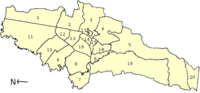
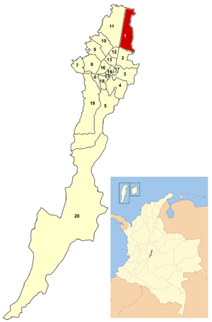
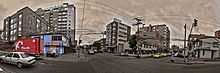
Usaquén
 Usaquén in Bogotá | |
| Area: | 65.31 km² |
|---|---|
| Population: | 489.216 (2008)[1] |
| Type of locality: | Mixed |
Usaquén is a residential and commercial locality (district) in northern Bogotá, capital of Colombia. Although it is designated on maps as Bogotá's #1 locality, it was a separate municipality of Cundinamarca until 1954, when it was annexed into the city. Today, Usaquén is home of more than 480 000 inhabitants as projected by 2008.[1] The Cordillera Oriental forms a natural border to the east.
General information
Borders
North: The municipality of Chía
East: The municipality of La Calera
South: The locality of Chapinero
West: The locality of Suba
Sites of interest
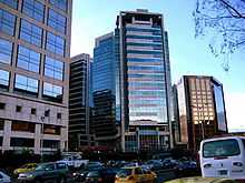
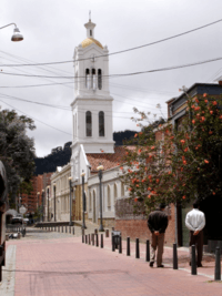
- The colonial quarter of Usaquén includes most of the buildings which belonged to the old municipality of the same name. These buildings are characterized by its Spanish colonial style architecture, similar of those in the La Candelaria neighborhood. Some important buildings in the area include: the Santa Barbara church (constructed in 1665 and modernized in the 20th century), the old country manor of the same name (now a mall) and the San José de Usaquén seminar and a variety of good restaurants.
- Country Club, the largest golf club in Bogotá.
- Hacienda Santa Barbara, a colonial style Hacienda that now serves as a shopping mall.
- Unicentro, Bogota's most traditional shopping mall dating back to the mid seventies.
- Santa Ana Centro Comercial, a very exclusive shopping mall.
History
The name comes from the cacique Usaque, which was founded by indigenous peoples in 1539 and abandoned by Spanish decree in 1777. It was gradually repopulated by people from Bogotá, and was host to some fighting during the war for Colombian independence. It was re-founded as a municipality in 1846, and in 1860 it was the scene of a battle between government troops and Tomás Cipriano de Mosquera. After winning that battle, Cipriano took power of the country.
Until 1954, the municipality covered 71 km², starting from Avenida España in the south and ending at 12 km on the road to Chía. It had traditionally been a spot for Bogotá's elites to maintain country homes. When it was integrated into the city, it maintained many of its municipal institutions, but with the supervision of Bogotá's mayor. Under the new constitution of 1991, Bogotá was reorganized into localities. Usaquén was numbered first of twenty.
On December 31, 1978, the guerrilla group M-19 took the military base called Cantón Norte, robbing the arsenal.
Neighborhoods and parks
Neighborhoods
Among the important neighborhoods are: Lijacá, Verbenal, San Antonio, Servitá, San Cristóbal Norte, Toberín, Cedritos, Bella Suiza, La Carolina, Santa Ana, Santa Barbara, San Gabriel Norte, Cantón Norte, Francisco Miranda, Las Margaritas, San Patricio and the old village of Usaquén.
Parks
Torca, located at the extreme north, is the locality's largest park.
The Country Club's polo area was acquired by the District and transformed into a metropolitan park for northern Bogotá. 1
External links
- (Spanish) City government site
- (Spanish) National University of Colombia site about Usaquén
- (Spanish) Unicentro mall website
- (Spanish) Hacienda Santa Barbara mall website
- (Spanish) Usaquen flea market website
- (Spanish) Directorio del barrio Cedritos en la localidad de Usaquén
References
- ↑ 1.0 1.1 "Cifras de Proyecciones de Población - Años 2004 a 2008: Proyección de la población por localidades". bogota.gov.co:8443. Retrieved 2010-06-03.
| ||||||||