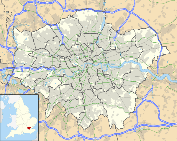
Upton Park, London
| Upton Park | |
 Boleyn Ground is synonymous with Upton Park |
|
 Upton Park |
|
| OS grid reference | TQ405837 |
|---|---|
| London borough | Newham |
| Ceremonial county | Greater London |
| Region | London |
| Country | England |
| Sovereign state | United Kingdom |
| Post town | LONDON |
| Postcode district | E6, E13 |
| Dialling code | 020 |
| Police | Metropolitan |
| Fire | London |
| Ambulance | London |
| EU Parliament | London |
| London Assembly | City and East |
Coordinates: 51°31′59″N 0°02′11″E / 51.533043°N 0.036472°E
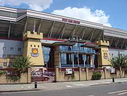
Upton Park is an urban area of the East London borough of Newham, centred on the local high street, Green Street. The area is synonymous with football and is home to West Ham United Football Club, who play at the Boleyn Ground, commonly known as Upton Park.
Football
The area is synonymous with football, as the southern end of Green Street runs alongside western edge of the Boleyn Ground, the home stadium of West Ham United which first opened in 1904. The club initially rented the land from Green Street House, known locally as Boleyn Castle because of its imposing nature and an association with Anne Boleyn. The football stadium has long since been commonly known as 'Upton Park'.
An unrelated football club of the area, Upton Park FC, were early pioneers in the game, and represented Great Britain at the 1900 Summer Olympics football tournament, where they won the gold medal. They played their home games in West Ham Park.
Upton Park F.C was founded in 1866, and is believed to have folded for the second and last time around 1911, while West Ham United, an unrelated organisation, were founded as Thames Ironworks F.C. in 1895, before reforming as West Ham in 1900, playing their first games at Upton Park, the Boleyn Ground, from 1904.
Transport
On the London Underground subway network, the southern area near the Boleyn Ground is served by Upton Park tube station on Green Street on the District and Hammersmith and City lines.
On the overground rail network, Forest Gate railway station on the Great Eastern Main Line served by Greater Anglia, and Wanstead Park railway station on the Gospel Oak to Barking Line served by the London Overground, are both located near the northern end of Green Street.
On the road network, Green Street itself runs on a north-south axis, linking the A118 Romford Road in the north and the A124 Barking Road in the south, both major arterial routes linking central London to the eastern counties.
Retail
Many shops in the area specifically cater for east London's large Asian community. Queens Road Market is a well known covered food and clothing market, which takes place on Queens Road, off of Green Street, near the tube station. It was formerly a large open-air street market until the current structure was built in the 1980s.
Priory Park
The Upton Park area also contains a green space named Priory Park 51°32′6.26″N 0°2′31.1″E / 51.5350722°N 0.041972°E, extending from the north east corner of the Boleyn Ground.
Administration
Green Street is a former tramway which divided the former Essex County Boroughs of East Ham and West Ham.
The Upton Park area is fully enclosed within the London Borough of Newham, but it is not the name of any of its electoral wards. It is roughly encompassed by the wards Green Street East/West in the north, and Plaistow North/South and Boleyn in the south.[1]
References
- ↑ Ward Profiles, Newham Information Management System, accessed 6 May 2010
| ||||||||||||||||||||||||||||||||||||
