Upper Worthington Historic District
|
Upper Worthington Historic District | |
 | |
|
City View Commons | |
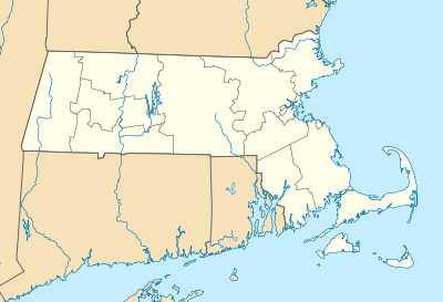 | |
| Location | Springfield, Massachusetts |
|---|---|
| Coordinates | 42°6′47″N 72°34′52″W / 42.11306°N 72.58111°WCoordinates: 42°6′47″N 72°34′52″W / 42.11306°N 72.58111°W |
| Built | 1908 |
| Architect | Gagnier & Angers et al. |
| Architectural style | Colonial Revival, Moderne, Tudor Revival |
| Governing body | Private |
| NRHP Reference # |
83000773 [1] |
| Added to NRHP | March 31, 1983 |
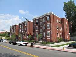
The Upper Worthington Historic District of Springfield, Massachusetts encompasses a collection of visually cohesive residential apartment blocks dating to the first three decades of the 20th century. It is centered on a portion of Worthington Street, a major east-west road in the city, between Armory Street and Summit Street, and includes 33 buildings on those three streets as well as Federal and Taylor Streets, near their junctions with either Worthington or Federal. Most of the contributing buildings are four story brick buildings with Georgian detailing and stone trim.[2]
The district was first listed on the National Register of Historic Places in 1983, including 28 buildings; the district was expanded in 1992 to add the five buildings on Taylor Street.[1][3]
See also
- National Register of Historic Places listings in Springfield, Massachusetts
- National Register of Historic Places listings in Hampden County, Massachusetts
References
- ↑ 1.0 1.1 "National Register Information System". National Register of Historic Places. National Park Service. 2008-04-15.
- ↑ "NRHP nomination for Upper Worthington Historic District". Commonwealth of Massachusetts. Retrieved 2013-12-10.
- ↑ "NRHP nomination for Upper Worthington Historic District boundary increase". Commonwealth of Massachusetts. Retrieved 2013-12-10.
| |||||||||||||||||||||||||||||||||||||||||||||||||||||||
