Upper Hill, Nairobi
| Upper Hill | |
|---|---|
|
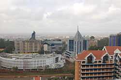
Upper Hill's skyline has significantly changed | |
| Nickname(s): Uppa/ Upper | |
 Upper Hill Location of Upper Hill, Nairobi in Kenya | |
| Coordinates: 01°18′05″S 36°49′03″E / 1.30139°S 36.81750°E | |
| Country |
|
| County | Nairobi County |
| City | Nairobi |
| Elevation | 5,600 ft (1,700 m) |
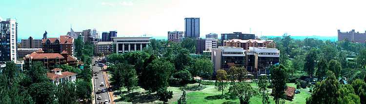
Upper Hill is an upcoming business district in the city of Nairobi, Kenya's largest city.
Location
Upper Hill is located 4.5 kilometres (2.8 mi) by road west of the central business district of Nairobi.[1] The coordinates of Upper Hill are:01 18 05S, 36 49 03E (Latitude:-1.3015; Longitude:36.8175).[2]
Overview
Upper Hill was historically one of the residential neighbourhoods of the city of Nairobi, during the colonial times. The 700 acres that comprise Upper Hill were previously owned by Kenya Railways.[3] During the 1990s and early 2000s, as land and office space have become scarce and exorbitantly priced in the central business district, more businesses have relocated to Upper Hill and Westlands, where land and office space are more readily available and less expensive.
Population
The population of Upper Hill, Nairobi is not publicly known, as of November 2010.
Landmarks
In Upper Hill or near the boundaries of the suburb, there are several landmarks, including the following:
- The Kenyan regional offices of EMC Corporation
- Nairobi Hospital
- The headquarters of the Kenya Ministry of Health
- Nairobi Club Ground – An upscale private membership cricket club, with a clubhouse and cricket oval.
- The offices of the World Health Organization in Kenya
- The Upper Hill School
- The Kenyan headquarters of the African Development Bank
- The Kenyan headquarters of Citibank
- The East and Central African headquarters of Coca Cola
- The Rahimtulla Tower, a twenty-two storey office skyscraper
- The Kenyan headquarters of PriceWaterhouseCoopers, located in the Rahimtulla Tower
- The Kenyan headquarters of Africaonline, located in the Rahimtulla Tower
- The Kenyan offices of the World Bank, located in Hill Park Building
- The Kenyan offices of the International Finance Corporation, located in the CBA Building.
- The headquarters of Victoria Commercial Bank, located in Victoria Towers on Kilimanjaro Avenue
- Kenya Commercial Bank Plaza (KCB Plaza) – Construction began in December 2010. Occupancy expected in 2013.[4]
See also
External links
References
| ||||||||||||