Upotipotpon, Victoria
| Upotipotpon Victoria | |
|---|---|
 Upotipotpon | |
| Coordinates | 36°28′S 145°46′E / 36.467°S 145.767°ECoordinates: 36°28′S 145°46′E / 36.467°S 145.767°E |
| Postcode(s) | 3673 |
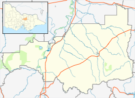
| Location |
|
| LGA(s) | Shire of Strathbogie |
| State electorate(s) | Euroa |
| Federal Division(s) | Murray |
Upotipotpon was a very small town and is now a rural area in Victoria, Australia, 208 kilometres (129 mi) north east of the state capital, Melbourne and 27 kilometres (17 mi) km north of Violet Town.
The name perhaps may have been derived from Aboriginal words pootong pootong, meaning "plenty of grass". The name was used for a pastoral property taken up in 1841 between the Broken River and Stony Creek.
In 1911 the population was 240 and in 1933 it was 131. Today, a handful of families remain living on sheep farms (including Redwood Farm) scattered around the area.
A Post Office, Upotipotpon Station, opened around 1902, was renamed Upotipotpon around 1907 and closed in 1913.[1]
Upotipotpon is one of the home towns listed on the Australian War Memorial in London.[2]
Upotipotpon is now a stronghold for woodland conservation in Victoria. It has a large number of declining woodland birds, well-treed roadsides and large patches of woodland vegetation. The agricultural landscape of the area is changing, with olive and farm forestry plantations becoming prominent as well as a number of properties being managed for conservation. The area has one of the few remaining large populations of Grey-crowned Babblers in the State.
References
- ↑ Premier Postal History. "Post Office List". Retrieved 2008-04-11.
- ↑ "Australian War Memorial, London - Placenames". Department of Veterans Affairs (Australia). Retrieved 2007-08-07.
| ||||||
Used to be the imaginary city of Mr. Chalks Geography lessons.