Union County, South Dakota
| Union County, South Dakota | |
|---|---|
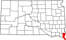 Location in the state of South Dakota | |
 South Dakota's location in the U.S. | |
| Founded | April 10, 1862 |
| Seat | Elk Point |
| Largest city | North Sioux City |
| Area | |
| • Total | 467 sq mi (1,210 km2) |
| • Land | 461 sq mi (1,194 km2) |
| • Water | 6.6 sq mi (17 km2), 1.4% |
| Population | |
| • (2010) | 14,399 |
| • Density | 31/sq mi (12/km²) |
| Congressional district | At-large |
| Time zone | Central: UTC-6/-5 |
| Website |
unioncountysd |
Union County is a county located in the U.S. state of South Dakota. As of the 2010 census, the population was 14,399.[1] Its county seat is Elk Point.[2] Originally named Cole County, the named was changed to Union because of Civil War sentiment.
Union County is part of the Sioux City, IA–NE–SD Metropolitan Statistical Area. Progressive Farmer rated Union County second in the 2006 "Best Place to Live" in the U.S., because "its schools are good, its towns neat and its people friendly."
Geography
According to the U.S. Census Bureau, the county has a total area of 467 square miles (1,210 km2), of which 461 square miles (1,190 km2) is land and 6.6 square miles (17 km2) (1.4%) is water.[3] It is the fifth-smallest county in South Dakota by area.
Major highways
 Interstate 29
 South Dakota Highway 11
 South Dakota Highway 19
 South Dakota Highway 46
 South Dakota Highway 48
 South Dakota Highway 50
 South Dakota Highway 105
Adjacent counties
- Lincoln County, South Dakota - north
- Sioux County, Iowa - northeast
- Plymouth County, Iowa - east
- Woodbury County, Iowa - southeast
- Dakota County, Nebraska - south
- Dixon County, Nebraska - southwest
- Clay County, South Dakota - west
Protected areas
- Missouri National Recreational River (part)
- Adams Homestead and Nature Preserve
- Union Grove State Park
Demographics
| Historical population | |||
|---|---|---|---|
| Census | Pop. | %± | |
| 1870 | 3,507 | — | |
| 1880 | 6,813 | 94.3% | |
| 1890 | 9,130 | 34.0% | |
| 1900 | 11,153 | 22.2% | |
| 1910 | 10,676 | −4.3% | |
| 1920 | 11,099 | 4.0% | |
| 1930 | 11,480 | 3.4% | |
| 1940 | 11,675 | 1.7% | |
| 1950 | 10,792 | −7.6% | |
| 1960 | 10,197 | −5.5% | |
| 1970 | 9,643 | −5.4% | |
| 1980 | 10,938 | 13.4% | |
| 1990 | 10,189 | −6.8% | |
| 2000 | 12,584 | 23.5% | |
| 2010 | 14,399 | 14.4% | |
| Est. 2014 | 15,029 | 4.4% | |
As of the census[8] of 2000, there were 12,584 people, 4,927 households, and 3,517 families residing in the county. The population density was 27 people per square mile (11/km²). There were 5,345 housing units at an average density of 12 per square mile (4/km²). The racial makeup of the county was 96.85% White, 1.34% Asian, 0.37% Native American, 0.01% Pacific Islander, 0.33% Black or African American, 0.24% from other races, and 0.87% from two or more races. 1.26% of the population were Hispanic or Latino of any race.
There were 4,927 households out of which 34.80% had children under the age of 18 living with them, 62.00% were married couples living together, 6.30% had a female householder with no husband present, and 28.60% were non-families. 24.20% of all households were made up of individuals and 10.30% had someone living alone who was 65 years of age or older. The average household size was 2.53 and the average family size was 3.02.
In the county, the population was spread out with 27.00% under the age of 18, 7.30% from 18 to 24, 28.40% from 25 to 44, 23.70% from 45 to 64, and 13.50% who were 65 years of age or older. The median age was 37 years. For every 100 females there were 99.20 males. For every 100 females age 18 and over, there were 98.30 males.
The median income for a household in the county was $44,790, and the median income for a family was $51,227. Males had a median income of $35,406 versus $23,440 for females. The per capita income for the county was $24,355. About 3.70% of families and 5.50% of the population were below the poverty line, including 4.90% of those under age 18 and 10.70% of those age 65 or over.
Communities
Cities
- Alcester
- Beresford
- Elk Point
- Jefferson
- North Sioux City (county seat)
Census-designated places
Unincorporated communities
- Alsen
- Garryowen
- Nora
Ghost towns
- Emmet
- Gothland
- Hill Side
- Texas
- Morganfield
Townships
The county is divided into thirteen townships:
- Alcester
- Big Sioux
- Big Springs
- Brule
- Civil Bend
- Elk Point
- Emmet
- Jefferson
- Prairie
- Quincy
- Sioux Valley
- Spink
- Virginia
Unorganized territory
The county contains one area of unorganized territory: Richland.
See also
References
- ↑ 1.0 1.1 "State & County QuickFacts". United States Census Bureau. Retrieved November 28, 2013.
- ↑ "Find a County". National Association of Counties. Retrieved 2011-06-07.
- ↑ "2010 Census Gazetteer Files". United States Census Bureau. August 22, 2012. Retrieved March 28, 2015.
- ↑ "U.S. Decennial Census". United States Census Bureau. Retrieved March 28, 2015.
- ↑ "Historical Census Browser". University of Virginia Library. Retrieved March 28, 2015.
- ↑ Forstall, Richard L., ed. (March 27, 1995). "Population of Counties by Decennial Census: 1900 to 1990". United States Census Bureau. Retrieved March 28, 2015.
- ↑ "Census 2000 PHC-T-4. Ranking Tables for Counties: 1990 and 2000" (PDF). United States Census Bureau. April 2, 2001. Retrieved March 28, 2015.
- ↑ "American FactFinder". United States Census Bureau. Retrieved 2011-05-14.
External links
- Union County Historical Society website
- 2nd Best Place to Live in 2006 from the Progressive Farmer website
 |
Lincoln County | Sioux County, Iowa | | |
| Clay County | |
Plymouth County, Iowa | ||
| ||||
| | ||||
| Dixon County, Nebraska | Dakota County, Nebraska | Woodbury County, Iowa |
| |||||||||||||||||||||||||||||