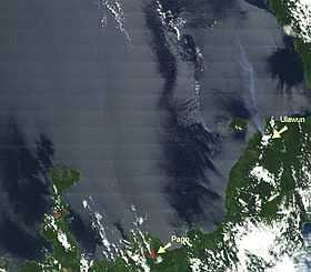
Ulawun
| Ulawun | |
|---|---|
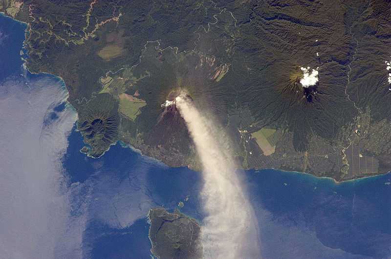
 Ulawun issuing passive steaming | |
| Elevation | 2,334 m (7,657 ft) |
| Prominence | 2,334 m (7,657 ft) |
| Listing | Ultra |
| Location | |
 Ulawun Papua New Guinea | |
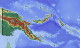
| Location | West New Britain, Papua New Guinea |
| Coordinates | 5°03′00″S 151°20′00″E / 5.05000°S 151.33333°ECoordinates: 5°03′00″S 151°20′00″E / 5.05000°S 151.33333°E |
| Geology | |
| Type | Stratovolcano |
| Volcanic arc/belt | Bismarck volcanic arc |
| Last eruption | 2013 to 2014 |
Ulawun is a basaltic and andesitic stratovolcano situated on the island of New Britain, Papua New Guinea, about 130 km southwest of Rabaul. It is the highest mountain in the Bismarck Archipelago at 2,334 metres (7,657 ft), and one of the most active volcanoes in Papua New Guinea. The first recorded eruption of Ulawun was by William Dampier in 1700; there have been 22 recorded eruptions since the 18th century. Several thousand people live near the volcano.
Recent activity
The last few years have seen almost constant activity at Ulawun, with frequent small explosions.
Volcanoes in Papua New Guinea are some of the world's most prolific sources of sulphur dioxide. Recent studies have shown that Ulawun releases about 7 kg/s of SO2, which is about 2% of the global total of SO2 emissions into the atmosphere.
View
Decade Map
Ulawun has been named one of the Decade Volcanoes, 17 volcanoes identified as being worthy of particular study, in light of their history of large, destructive eruptions and their proximity to populated areas.
.svg.png)
See also
References
- McGonigle A.J.S., Oppenheimer C., Tsanev V.I. et al. (2004), Sulphur dioxide fluxes from Papua New Guinea's volcanoes, Geophysical Research Letters, v. 31, issue 8
External links
- Information from the Papua New Guinea Geological Survey
- "Ulawun". Global Volcanism Program. Smithsonian Institution. Retrieved 2010-03-15.
- "Mount Ulawun, Papua New Guinea" on Peakbagger