Uhelná Příbram
| Uhelná Příbram | ||
|---|---|---|
| Městys | ||
 | ||
| ||
 Uhelná Příbram | ||
| Coordinates: 49°46′0″N 15°35′5″E / 49.76667°N 15.58472°ECoordinates: 49°46′0″N 15°35′5″E / 49.76667°N 15.58472°E | ||
| Country |
| |
| Region | Vysočina | |
| District | Havlíčkův Brod | |
| Area | ||
| • Total | 21.81 km2 (8.42 sq mi) | |
| Elevation | 485 m (1,591 ft) | |
| Population (1.1.2014) | ||
| • Total | 504 | |
| • Density | 23/km2 (60/sq mi) | |
| Postal code | 582 45 to 583 01 | |
| Website | http://www.uhelnapribram.cz | |

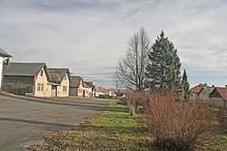
Uhelná Příbram is a small town (městys) in Havlíčkův Brod District in the Vysočina Region of the Czech Republic.
The town covers an area of 21.81 square kilometres (8.42 sq mi), and has a population of 525 (as at 28 August 2006).
Uhelná Příbram lies approximately 18 kilometres (11 mi) north of Havlíčkův Brod, 42 km (26 mi) north of Jihlava, and 91 km (57 mi) south-east of Prague.
References
| Wikimedia Commons has media related to Uhelná Příbram. |