Udall, Missouri
| Udall, Missouri | |
|---|---|
| Community | |
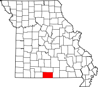
 Udall, Missouri Location of Udall, Missouri | |
| Coordinates: 36°32′33″N 92°15′45″W / 36.54250°N 92.26250°WCoordinates: 36°32′33″N 92°15′45″W / 36.54250°N 92.26250°W[1] | |
| Country | U. S. A. |
| State | Missouri |
| County | Ozark County |
| Elevation[1] | 250 m (820 ft) |
| Time zone | CST (UTC-6) |
| • Summer (DST) | CDT (UTC-5) |
Udall is an unincorporated community in Ozark County in southern Missouri about twelve miles southeast of Gainesville and eight miles west of Bakersfield on Missouri Route O. One and a half miles west of Udall the road ends at a park and landing on Norfork Lake.[1]
History
In 1848 a post office was established in the community and named St. Ledger. In 1855 the post office and community were renamed Udall.[2]
References
- ↑ 1.0 1.1 1.2 Udall Quadrangle, Missouri–Ozark County, 7.5 Minute Series, USGS, 1968
- ↑ Ozark County Place Names, 1928-1945, The State Historical Society of Missouri
| |||||||||||||||||||||||||||||