Ubon Ratchathani Province
| Ubon Ratchathani อุบลราชธานี | ||
|---|---|---|
| Province | ||
| ||
| Nickname(s): Ubon | ||
 Map of Thailand highlighting Ubon Ratchathani Province | ||
| Country |
| |
| Capital | Ubon Ratchathani | |
| Government | ||
| • Governor | Wichit Chatpaisit (Interrim Governor)(since 2010) | |
| Area | ||
| • Total | 16,112.650 km2 (6,221.129 sq mi) | |
| Area rank | Ranked 5th | |
| Population (2014) | ||
| • Total | 1,844,669 | |
| • Rank | Ranked 3rd | |
| • Density | 110/km2 (300/sq mi) | |
| • Density rank | Ranked 44th | |
| Time zone | Thailand Standard Time (UTC+7) | |
| ISO 3166 code | TH-34 | |
Ubon Ratchathani (often in short Ubon, Thai: อุบลราชธานี) is one of the north-eastern provinces (changwat) of Thailand, and the country's easternmost. Ubon is about 600 km (370 mi) away from Bangkok. Neighboring Provinces are (from west clockwise) Sisaket, Yasothon and Amnat Charoen. To the north and east it borders Salavan and Champasak of Laos, to the south Preah Vihear of Cambodia.
Geography

At Khong Chiam the Mun river, the biggest river of the Khorat Plateau, joins the Mekong, which forms the north-eastern boundary of Thailand with Laos. It is called Maenam Song Si or the Mun River alluvium because the brown water from Mekong River is mixed with blue water from Mun River. It is located about 84 km (52 mi). from Ubon Ratchathani City centre.
The area in the Dângrêk Mountains where the borders of the three countries Thailand, Laos and Cambodia meet is promoted as the Emerald Triangle, in contrast to the Golden Triangle in the north of Thailand. The Emerald refers to the large intact monsoon forests there.
Another natural place is namtok Saeng Chan. This waterfall is 1 km (0.62 mi) from Thung Na Muang Waterfall.
Climate
| Climate data for Ubon Ratchathani (1981–2010) | |||||||||||||
|---|---|---|---|---|---|---|---|---|---|---|---|---|---|
| Month | Jan | Feb | Mar | Apr | May | Jun | Jul | Aug | Sep | Oct | Nov | Dec | Year |
| Average high °C (°F) | 31.7 (89.1) |
34.0 (93.2) |
35.8 (96.4) |
36.4 (97.5) |
34.7 (94.5) |
33.3 (91.9) |
32.6 (90.7) |
31.9 (89.4) |
31.8 (89.2) |
31.8 (89.2) |
31.4 (88.5) |
30.6 (87.1) |
33 (91.39) |
| Average low °C (°F) | 17.5 (63.5) |
19.9 (67.8) |
22.5 (72.5) |
24.4 (75.9) |
24.5 (76.1) |
24.4 (75.9) |
24.2 (75.6) |
23.9 (75) |
23.7 (74.7) |
22.5 (72.5) |
20.3 (68.5) |
17.8 (64) |
22.13 (71.83) |
| Average rainfall mm (inches) | 2.0 (0.079) |
15.4 (0.606) |
30.5 (1.201) |
86.8 (3.417) |
208.6 (8.213) |
240.2 (9.457) |
254.4 (10.016) |
303.3 (11.941) |
293.8 (11.567) |
123.1 (4.846) |
22.6 (0.89) |
1.0 (0.039) |
1,581.7 (62.272) |
| Avg. rainy days (≥ 1 mm) | 1 | 1 | 3 | 8 | 15 | 19 | 19 | 22 | 20 | 11 | 4 | 1 | 124 |
| Average relative humidity (%) | 65 | 63 | 62 | 66 | 75 | 79 | 80 | 82 | 82 | 78 | 71 | 68 | 72.6 |
| Mean monthly sunshine hours | 293.3 | 262.9 | 270.8 | 256.0 | 238.4 | 189.6 | 198.4 | 170.1 | 163.5 | 228.5 | 255.6 | 274.0 | 2,801.1 |
| Source: Thai Meteorological Department (Normal 1981-2010), (Avg. rainy days 1961-1990) | |||||||||||||
History
The city was founded in the late 18th century by Thao Kham Phong, descendant of Phra Wo and Phra Ta, who escaped from King Siribunsan of Vientiane into Siam Kingdom during the reign of King Taksin the Great. Later Thao Kham Phong was appointed to be “Phra Pathum Wongsa" The first ruler of Ubon Ratchathani. In 1792 Ubon Ratchathani became a province, and was also the administrative center of the monthon Isan. Until 1972 the Ubon Ratchathani Province was the largest province of Thailand by area. Yasothon province was split off from Ubon Ratchathani Province in 1972, followed by Amnat Charoen province in 1993.
Before it became a province. Ubon Ratchathani was the administrative center of the monthon Isan, of which monthon Ubon was split off. In 1925 it became part of monthon Nakhon Ratchasima, with the abolishment of the monthon in 1933 the province became a first level subdivision of the country.
National parks
Ubon Ratchathani boasts the following national parks:
- Phu Chong-Na Yoi National Park is in mountainous areas in the province.
- Kaeng Tana National Park is in Khong Chiam District.
- Pha Taem National Park covers an area of 140 km2 (54 sq mi). Plateaus and hills dominate the park landscape. The sheer cliffs here are a result of earthquakes. The interesting places in the national park are Pha Taem and Pha Kham. On the cliffs surface are numerous prehistoric cave paintings from 3,000-4,000 years ago. These paintings depict scenes of fishing, rice farming, figures of people, animals, hands and geometric designs that show the way of life during the pre-historic time and reflect the ancient lifestyle of the people who lived there.[1]
Education
Ubon Ratchathani province is the main site of Ubon Ratchathani University.
Symbols
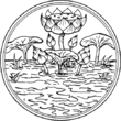
The provincial seal shows a Lotus flower in a pond. This refers to the meaning of the name of the province, which translates to Royal city of the lotus flower. Therefore the provincial flower also is the Lotus (Nymphaea lotus). The provincial tree is the Yang-na (Dipterocarpus alatus).
Administrative divisions

The province is subdivided into 25 districts (amphoe). The districts are further subdivided into 219 subdistricts (tambon) and 2469 villages (muban). The numbers missing in the table are the districts which formed the province Amnat Charoen in 1993.
|
|
Municipalities
| Nr. | City/Town | Thai | Urban Population | Notes |
|---|---|---|---|---|
| 1. | Ubon Ratchathani | เทศบาลนครอุบลราชธานี | 85,557 Inh. | Capital of the province,Historic town,Touristical,International Airport |
| 2. | Warin Chamrap | เทศบาลเมืองวารินชำราบ | 30,521 Inh. | Educational, Railway Terminal |
| 3. | Phibun Mangsahan | เทศบาลเมืองพิบูลมังสาหาร | 11,326 Inh. | |
| 4. | Det Udom | เทศบาลเมืองเดชอุดม | 14,933 Inh. | |
| 5. | Kham Yai | เทศบาลตำบลขามใหญ่ | 54,679 Inh. | |
| 6. | Saen Suk | เทศบาลตำบลแสนสุข | 23,070 Inh. | |
| 7. | Trakan | เทศบาลตำบลตระการ | 7,672 Inh. | |
| 8. | Nam Yuen | เทศบาลตำบลน้ำยืน | 9,644 Inh. | |
| 9. | Pathum | เทศบาลตำบลปทุม | 10,679 Inh. | |
| 10. | Ubon | เทศบาลตำบลอุบล | 6,070 Inh. | |
| 11. | Huai Khayung | เทศบาลตำบลห้วยขะยูง | 3,64 6 Inh. |

Tourism
Sights
Thung Si Mueang (ทุ่งศรีเมือง) - is a landscaped public park in the heart of the city in front of the city hall. It houses an imitation of a carved candle sculpture, health park, and playground.
City Pillar Shrine (ศาลหลักเมือง) - Located at the southern corner of the field, the sacred pillar was built in 1972.
Monument of Phra Pathum Worarat Suriyawong or Chao Kham Phong (อนุสาวรีย์พระปทุมวรราชสุริยวงศ์ หรือ เจ้าคำผง) - Phra Pathum Worarat Suriyawong is the founder of Ubon Ratchathani during 1778-1795.
Sculpture of Somdet Phra Maha Wirawong or Tisso Uan (ปฏิมากรรมสมเด็จพระมหาวีรวงศ์ หรือ ติสโส อ้วน) - a famous monk who was well versed in Sutra and Vipassana.
Monument of Goodness (อนุสาวรีย์แห่งความดี) - The monument was built by WWII PoWs to honour the generosity and goodness of the people of Ubon Ratchathani.
Sculpture of Harmony and Progress (ปฏิมากรรมร่วมใจก้าวไปข้างหน้า) - The sculpture represents the harmony of 4 countries: Thailand, Lao PDR., Cambodia, and Vietnam.
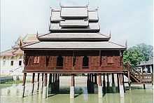
Wat Thung Si Mueang (วัดทุ่งศรีเมือง) The Buddha’s footprint is housed in the Ubosot which mirrors art blending between the early Rattanakosin era and that of Vientiane. Another important building in the temple is the Ho Trai - the Hall of Tipitaka scriptures. The wooden hall was built in the pond to protect the Tipitaka from insects.
Wat Si Ubon Rattanaram or Wat Si Thong (วัดศรีอุบลรัตนาราม หรือ วัดศรีทอง) - The Ubosot houses a sacred Buddha image known as “Phra Kaeo Butsarakham”. The Buddha image, in the attitude of subduing Mara, is carved from topaz into the Chiang Saen style. Each year, in the Songkran Festival, people parade the Buddha image for the people to pay their respects to and bathe.
National Museum of Ubon Ratchathani (พิพิธภัณฑสถานแห่งชาติ อุบลราชธานี) - The single-storey hip roofed building, built in 1918, once served as the city hall before it was handed to the Fine Arts Department. The museum has exhibitions on local geography, history of the city’s establishment, archaeological fine art objects, local handicrafts and folk games.
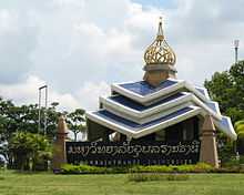
The Golden Jubilee Art and Cultural Centre (ศูนย์ศิลปวัฒนธรรมกาญจนาภิเษก) - The 7-storey building in contemporary Isan architecture was built to commemorate the Golden Jubilee Celebrations of the King's accession to the throne. Princess Maha Chakri Sirindhorn presided over the opening ceremony on 11 December 2001.
Wat Chaeng (วัดแจ้ง) - The Ubosot, which was only completed 24 years later, is noted for its architecture and rare woodcarving. As a heritage site, the Ubosot is well preserved in its original condition. It won a Certificate of Honour from Princess Maha Chakri Sirindhorn in the ‘Architect 87’ Exhibition.
Wat Maha Wanaram (วัดมหาวนาราม) - It was at first only a ‘Samnak Song’, a monastic residence, for Vipassana monks. According to a stone inscription found behind the principal Buddha statue, Phrachao Yai In Paeng, it was built in 1807. The stucco Buddha statue, in the attitude of subduing Mara, was built in the Laotian style.
Wat Burapharam (วัดบูรพาราม) - The temple once served as a residence for famous meditation monks. Today, the temple houses lifelike stone figures of these monks.
Wat Supattanaram Worawihan (วัดสุปัฏนารามวรวิหาร) - This is the first Dhammayutika temple of the province. The temple has a special Ubosot designed by a royal highway engineer Luang Sathit Nimankan (Chuan Supiyaphan). It has a Thai-style roof, western style hall and Khmer-style base.
Hat Wat Tai (หาดวัดใต้) - The beach situated in the middle of the Mun River. During the dry season, its white sandy beach is a tourist destination.
Ban Kan Lueang Archaeological Site (แหล่งโบราณคดีบ้านก้านเหลือง) - It is an archaeological site which can be dated back to 2,800-2,500 years ago. In 1996, the Fine Arts Department found a number of artefacts such as beads, pottery, bronze bells, iron axes and chaff.
Wat Sa Prasan Suk or Wat Ban Na Mueang (วัดสระประสานสุข หรือ วัดบ้านนาเมือง) - The temple houses a special Ubosot in the shape of the Suphannahong Royal Barge decorated with mosaic. The abbot is Achan Bunmi.
Hat Khu Duea (หาดคูเดื่อ) - The beach by the Mun River is 12 km (7.5 mi) from downtown Ubon Ratchathani via Highway 24.
Ban Pa-ao (บ้านปะอาว) - The ancient village is situated in Tambon Nong Khon. Two centuries ago, the villagers immigrated from Vientiane during the reign of King Siri Bunsan. The village produces brass work in an ancient style.
Wat Nong Pa Phong (วัดหนองป่าพง) - The temple is situated in a lush forest of Tambon Non Phueng. Monks study and practice Vipassana meditation there. The temple has the Phra Phothiyan Thera Museum that displays the eight requisites and wax model of Luangpu Cha.
Wat Pa Nana Chat (วัดป่านานาชาติ) - Numerous foreign monks study and practice Vipassana meditation here; most of them can speak Thai fluently and pray in Pali. The monks observed strict practices.
Wat Phukhao Kaeo (วัดภูเขาแก้ว) - The temple has a Ubosot delicately decorated with a tiered roof covered with terracotta tiles and supporting a golden spire in the middle. Inside is a high-relief regarding important Phrathats, relic-containing pagodas, of Thailand.
Kaeng Saphue (แก่งสะพือ) - The rapids in the Mun River. ‘Saphue’ derives from the word ‘Samphuet’ in Suai ethnic language which means large serpent.
Sirindhorn Dam (เขื่อนสิรินธร) - Called Khuean Dom Noi by the people of the area, the rockfill dam with a clay core was constructed across the Lam Dom Noi, a tributary of the Mun River. The hydroelectric dam is 42 metres high and 940 metres long.
Chong Mek (ช่องเม็ก) - The permanent Thai-Lao border pass is 90 km (56 mi) from downtown Ubon Ratchathani. The pass is a land bridge to Champasak Province.
Kaeng Tana National Park (อุทยานแห่งชาติแก่งตะนะ) - The park features plateaux and undulating hills with deciduous dipterocarp forest and grassland. In the park are:
Don Tana (ดอนตะนะ) - An island in the middle of the Mun River 450 m (1,480 ft) wide and 700 m (2,300 ft) metres long.
Kaeng Tana (แก่งตะนะ) - The largest rapids of the Mun River. In the middle of the rapids, there is a huge sandstone boulder splitting the river into two streams, and a concrete block built during the French Colonial Era to identify a channel for cruising.
Tham Phra or Tham Phu Ma Nai (ถ้ำพระหรือถ้ำภูหมาไน) - A stone inscription and Lingam base or ‘Yoni’ from the 7th-8th Century were found. Now the original stone inscription is kept in the National Museum, Ubon Ratchathani.
Namtok Rak Sai Nature Trail (เส้นทางศึกษาธรรมชาติน้ำตกรากไทร) - The trail lines the cliff by the Mun River, 500 m (1,640 ft) from the park’s headquarters. It runs by the cliff for 1 km (0.62 mi). through various kinds of flora, such as lichen, moss, and fern, Tham Phra and Namtok Rak Sai.
Namtok Tat Ton (น้ำตกตาดโตน) - The waterfall is situated on Highway 2173, off Highway 217 by 5 km (3.1 mi).
Annamese Lion Pulpit at Ban Chi Thuan (ธรรมาสน์สิงห์ศิลปะญวนที่บ้านชีทวน) - The Buddhist pulpit is placed at Wat Sinuan Saeng Sawang Arom. The concrete pulpit itself is unique, with a lion sculpture carrying the pulpit with decorative stucco, multi-layer wooden roof, and painting in the Annamese style.
Wat Thung Si Wilai (วัดทุ่งศรีวิไล) - The temple houses Luangpho Wiset, the principal Buddha image carved from laterite seated beneath the Naga's hood. The Buddha image from the Dvaravati period is considered a sacred icon for the village. The temple is surrounded by several enclosures of Sima stones that mark the temple’s consecrated boundary.
Wat Tham Kuha Sawan (วัดถ้ำคูหาสวรรค์) - The temple was built by Luangpu Khamkhaning Chulamani to be a place for meditation practice where he also resided. After his death Luangpu's death his body, which did not decompose, was put in a glass coffin and is considered sacred.
Maenam Song Si (แม่น้ำสองสี) - At the mouth of the Mun River, Ban Woen Buek. The Mun River runs into the Mekong, so we can see two rivers, in two different colours – ‘Song Si’ means two colours - blending together. The Mekong River is reddish brown, while the Mun River is rather blue.
Pha Taem National Park (อุทยานแห่งชาติผาแต้ม) - The park features plateaux, undulating hills, and towering cliffs with strange sandstone formations scattered around. The park is covered mostly by deciduous dipterocarp forest and wild flowers can be found on the rock terrace. In the park are:
Sao Chaliang (เสาเฉลียง) - Carved by wind and water for millions of years, the mushroom-like stone towers are scattered around the area containing shell fossils, sand and gravels in their texture. Geologists think that over a million years ago this area was a sea.
Pha Taem and Pha Kham (ผาแต้มและผาขาม) - The towering cliffs house groups of prehistorical paintings which date back to 3,000-4,000 years ago. There are over 300 paintings in five categories including animals, geometrical motifs, rice farmers, hands, and ‘Tum’ or typical fish trap.
Namtok Soi Sawan (น้ำตกสร้อยสวรรค์) - Two streams, Huai Soi and Huai Phai, combine and plunge 20 metres down to the pond below, making the waterfall look like a necklace – ‘Soi’ in Thai.
Namtok Thung Na Mueang (น้ำตกทุ่งนาเมือง) - The medium-sized waterfall cascades down a 25-metre cliff through flowerbeds which are in full bloom between October to December.
Namtok Saeng Chan or Namtok Ru (น้ำตกแสงจันทร์หรือ น้ำตกรู) - The tiny fall is special as the stream falls through a hole – ‘Ru’ – down to the pond below. At noon, sunshine through the hole makes the waterfall look like a ray of moonshine – ‘Saeng Chan’.
Dong Na Tham Forest (ป่าดงนาทาม) - From September to November is the best time to visit as flowers are in full bloom. There are waterfalls and fogs over the Mekong River. From January to March the forest changes its hue, with trees shedding their leaves, and cruises in the Mekong run from Ban Pak La to Khan Tha Kwian.
Wat Phu Anon (วัดภูอานนท์) - The temple has interesting attractions including a rock terrace with large footprints, nature-made stone jar, and cave painting.
Phu Lon (ภูหล่น) - The mountain is in Tambon Song Yang, 20 km (12 mi) north of Amphoe Si Mueang Mai. It has a cave where monk Phra Achan Man Phurithatto practiced his Vipassana.
Namtok Huai Sai Yai or Kaeng I Khiao (น้ำตกห้วยทรายใหญ่ หรือ แก่งอีเขียว) - The waterfall is in the Buntharik - Khao Yot Mon Wildlife Sanctuary. The waterfall runs over the rock terrace among a shady environment.
Phu Chong - Na Yoi National Park (อุทยานแห่งชาติภูจอง-นายอย) - The park covers a total area of 686 km2 (265 sq mi). Its boundary connects to Lao PDR and Cambodia in the area called the Emerald Triangle. In the park are:
Namtok Huai Luang or Namtok Bak Teo (น้ำตกห้วยหลวง หรือ น้ำตกบักเตว) - Plunging down three steps from an elevation of 30 metres, the waterfall has a small pool with a white beach and turquoise coloured water.
Phlan Yao Rock Garden (สวนหินพลานยาว) - Rocks in different formations are scattered around the area.
Pha Phueng Viewpoint (จุดชมทิวทัศน์ผาผึ้ง) - The viewpoint is just next to the rock garden.
Namtok Koeng Mae Phong (น้ำตกเกิ้งแม่พอง) - The waterfall is 9 km (5.6 mi) south of Namtok Huai Luang along the nature trail. It originates from the Lam Dom Noi Stream.
Kaeng Sila Thip (แก่งศิลาทิพย์) - Huai Luang Stream runs over a rock terrace and turns fierce in the rapids. In the middle of the stream, its power has created lots of holes on the rock surface in different sizes and depths called “Kumphalak.”
Phlan Kong Kwian (พลาญกงเกวียน) - The vast rock terrace with rock shelters at the front is home to wild flowers and plants. In previous days, travellers could seek shelter her; it came to be called Phlan Kong Kwian, which means cart terrace.
Phu Hin Dang (ภูหินด่าง) - a cliff-top place to view the forest scenery of Lao PDR. and Cambodia. The cliff is brightly coloured; geologists explain that this is due to dry weather millions of years ago catalyzing mineral residues in the seawater.
Namtok Kaeng Lamduan (น้ำตกแก่งลำดวน) - The fall is situated in the compound of the Ubon Ratchathani Wildlife Reservation Promotion and Development Station. The waterfall runs over a rock terrace and through the shady forest of Lamduan trees.
Prasat Ban Ben (ปราสาทบ้านเบญจ์) - The Khmer sanctuary is a religious site comprising three brick Prangs on separated laterite bases. The Fine Arts Department excavated the site in 1990 and found lintels featuring nine directional guardian angels and the God Indra on his Erawan heavenly elephant.
Local products
Ubon Ratchathani’s local products include hand-woven cotton, Khit pillow, loincloth, silk, brassware, and basketry.
Mu Yo (Moo Yaw) or preserved pork, Chinese sausage, Isan sausage, and Khem Mak Nat or black-eared catfish or iridescent shark-catfish in saline water with chopped pineapple. Various preserved and ready-to-eat food such as dried fish, dried frog’s skin, and steamed bun with bamboo shoot stuff.
Culture
Festivals
- Candle Festival (งานประเพณีแห่เทียนเข้าพรรรษา) - Held every July or August at Thung Si Mueang Public Park, Ubonratchathani District
- Flower Festival (งานเทศกาลไม้ดอกไม้ประดับ) - Held every February at Thung Kham Nam Saep Stadium, Amphoe Warin Chamrap, the festival features floral floats, decorative and flowering plant contests and fair.
- Kaeng Saphue Songkran Festival (งานประเพณีมหาสงกรานต์แก่งสะพือ) - Held every April in Amphoe Phibun Mangsahan, the festival comprises a beauty contest, fair, local sports, and local music contest.
- Illuminated Boat Procession (งานประเพณีไหลเรือไฟ) - Held every October to mark the end of the Buddhist Lent, boats from different temples will illuminate the river near the Rattanakosin Bicentennial Bridge.
- Traditional Boat Races (งานแข่งขันเรือยาวประเพณี) - Several boat racing tournaments are held annually in October after the end of the Buddhist Lent. The Mueang Ubon Ratchathani Municipality’s tournament is held near the Rattanakosin Bicentennial Bridge. Tambon Phibun Mangsahan Municipality’s tournament is held near the Mun River Bridge, and Wat Pho Tak’s tournament is held in front of the temple.
Transportation
By Air
- Thai Airways International operates direct flights from Suvarnabhumi Airport (Bangkok) to Ubon Ratchathani International Airport in Ubon Ratchathani. The Flight takes about 65 minutes. Air Asia[2] and Nok Airlines flies from Don Mueang Airport in Bangkok to Ubon Ratchathani.
By Bus
- International Bus - Ubon Ratchathani to Pakse
See also
- Khit cloth
External links
| Wikimedia Commons has media related to Ubon Ratchathani. |
References
 |
Amnat Charoen Province Yasothon Province |
Savannakhet Province, |
Salavan Province, |
|
| Sisaket Province | |
Champasak Province, | ||
| ||||
| | ||||
| Preah Vihear Province, |
Coordinates: 15°13′46″N 104°51′04″E / 15.22944°N 104.85111°E
| ||||||||||||||||||||||||||||||