Ubol Ratana Dam
| Ubolratana Dam | |
|---|---|
 Upstream side of dam | |
 | |
| Official name | Ubol Ratana Dam |
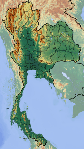
| Location | Khon Kaen Province, Thailand |
| Coordinates | 16°46′31.42″N 102°37′5.97″E / 16.7753944°N 102.6183250°ECoordinates: 16°46′31.42″N 102°37′5.97″E / 16.7753944°N 102.6183250°E |
| Opening date | 1966 |
| Owner(s) | Electricity Generating Authority of Thailand (EGAT) |
| Dam and spillways | |
| Type of dam | Earth core rock-fill dam |
| Impounds | Phong River |
| Height | 36.1 m (118 ft) |
| Length | 885 m (2,904 ft) |
| Reservoir | |
| Creates | Ubolratana Dam Reservoir |
| Total capacity | 2,559,000 m3 (90,400,000 cu ft) |
| Catchment area | 410 km2 (160 sq mi) |
| Power station | |
| Operator(s) | Electricity Generating Authority of Thailand (EGAT) |
| Turbines | 3 x 8.4 MW Kaplan-type |
| Installed capacity | 25.2 MW |
| Annual generation | 57 GWh |
The Ubol Ratana Dam (pronounced: Ubon Rat) - formerly known as the "Phong Neeb Dam" - is a multi-purpose dam located in Tambon Kok-Soong, Ubolratana District, approximately 50 km (31 mi) north of Khon Kaen, Khon Kaen Province, Thailand. It was the first hydroelectric power project developed in the Thailand's northeastern area of Isan. The dam impounds the Nam Phong, a tributary of the Mekong River. The dam was given its current name by Royal Permission in 1966, in honour of Thai princess Ubolratana Rajakanya.
Description
The dam is considered to have multi-purpose functions: electricity generation, irrigation, flood control, transportation, fisheries and as tourist attraction.[1] This is an earth core rockfill dam, and was constructed in 1964. It is 885 m (2,904 ft), and 31.5 m (103 ft) high. Its catchment area is 12,000 km2 (4,600 sq mi). Its reservoir has a maximum storage capacity of 2,559,000 m3 (90,400,000 cu ft).
In 1984, the dam was modified to reinforce dam safety and to ensure better flood protection. 30,000 people were resettled to make way for the large reservoir accompanying the dam. This resettlement resulted in a sharp decrease in forested areas in the catchment areas and an increase in erosion.
Power plant
The power plant, located at the dam, has three turbines, each with an installed capacity of 8,400 KW. The dam generates an average of 57 GWh a year. The operation of the turbines commenced on February 4, 1966, March 14, 1969 and June 12, 1968 respectively.[1]
History
The Ubol Ratana Dam was a product of the so-called "Lower Mekong Basin Project", which was conceived and coordinated by the Mekong Committee, the precursor to the Mekong River Commission. "So thorough have been the studies and the planning that only one of the committee's major river development projects has reached near-completion. It is the multipurpose Nam Pong project on a remote tributary of the Mekong in Northeastern Thailand. It was water from its rock-fill dam, completed in 1966, that was so needed so urgently by the village of Nong Ben in the summer of 1967. The dam, named Ubol Ratana, was producing power; its ultimate capacity will be 24,000 kilowatts".[2]
See also
- Mekong River Basin Hydropower
- Mekong River Commission
- Electricity Generating Authority of Thailand
References
- ↑ 1.0 1.1 "Renovation of Small Hydropower Plants by Hydropower Construction Division in 2005". Electricity Generating Authority of Thailand. Archived from the original on 2010-01-14. Retrieved 2011-01-30.
- ↑ "The Mekong Valley... Peace through prosperity". Pittsburgh Post-Gazette. 1968-10-27. Retrieved 2011-01-30.
External links
- CGIAR Challenge Program on Water and Food-Mekong
- Thailand National Mekong Committee
- Electricity Generating Authority of Thailand
- Mekong Program on Water, Environment and Resilience
- Mekong River Commission
| Wikimedia Commons has media related to Mekong. |