Turner County, South Dakota
| Turner County, South Dakota | |
|---|---|
 Turner County Courthouse in Parker | |
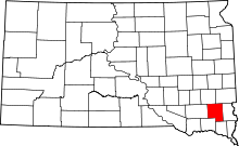 Location in the state of South Dakota | |
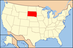 South Dakota's location in the U.S. | |
| Founded | 1871 |
| Named for | John W. Turner |
| Seat | Parker |
| Largest city | Parker |
| Area | |
| • Total | 618 sq mi (1,601 km2) |
| • Land | 617 sq mi (1,598 km2) |
| • Water | 0.6 sq mi (2 km2), 0.1% |
| Population | |
| • (2010) | 8,347 |
| • Density | 14/sq mi (5/km²) |
| Congressional district | At-large |
| Time zone | Central: UTC-6/-5 |
| Website |
turner |
Turner County is a county located in the U.S. state of South Dakota. As of the 2010 census, the population was 8,347.[1] Its county seat is Parker.[2] The county was established in 1871 and named for Dakota Territory official John W. Turner.[3]
Turner County is part of the Sioux Falls, SD Metropolitan Statistical Area.
Geography
According to the U.S. Census Bureau, the county has a total area of 618 square miles (1,600 km2), of which 617 square miles (1,600 km2) is land and 0.6 square miles (1.6 km2) (0.1%) is water.[4]
Major highways
 U.S. Highway 18
 U.S. Highway 81
 South Dakota Highway 19
 South Dakota Highway 44
 South Dakota Highway 46
- South Dakota Highway 19A
Adjacent counties
- Minnehaha County, South Dakota - northeast
- Lincoln County, South Dakota - east
- Clay County, South Dakota - southeast
- Yankton County, South Dakota - southwest
- Hutchinson County, South Dakota - west
- McCook County, South Dakota - northwest
Demographics
| Historical population | |||
|---|---|---|---|
| Census | Pop. | %± | |
| 1880 | 5,320 | — | |
| 1890 | 10,256 | 92.8% | |
| 1900 | 13,175 | 28.5% | |
| 1910 | 13,840 | 5.0% | |
| 1920 | 14,871 | 7.4% | |
| 1930 | 14,891 | 0.1% | |
| 1940 | 13,270 | −10.9% | |
| 1950 | 12,100 | −8.8% | |
| 1960 | 11,159 | −7.8% | |
| 1970 | 9,872 | −11.5% | |
| 1980 | 9,255 | −6.2% | |
| 1990 | 8,576 | −7.3% | |
| 2000 | 8,849 | 3.2% | |
| 2010 | 8,347 | −5.7% | |
| Est. 2014 | 8,272 | −0.9% | |

As of the census[9] of 2000, there were 8,849 people, 3,510 households, and 2,478 families residing in the county. The population density was 14 people per square mile (6/km²). There were 3,852 housing units at an average density of 6 per square mile (2/km²). The racial makeup of the county was 98.86% White, 0.15% Black or African American, 0.27% Native American, 0.17% Asian, 0.12% from other races, and 0.43% from two or more races. 0.41% of the population were Hispanic or Latino of any race.
There were 3,510 households out of which 31.60% had children under the age of 18 living with them, 61.90% were married couples living together, 5.60% had a female householder with no husband present, and 29.40% were non-families. 26.50% of all households were made up of individuals and 14.80% had someone living alone who was 65 years of age or older. The average household size was 2.46 and the average family size was 2.99.
In the county, the population was spread out with 25.80% under the age of 18, 6.20% from 18 to 24, 24.80% from 25 to 44, 22.80% from 45 to 64, and 20.40% who were 65 years of age or older. The median age was 40 years. For every 100 females there were 97.20 males. For every 100 females age 18 and over, there were 93.90 males.
The median income for a household in the county was $36,059, and the median income for a family was $42,704. Males had a median income of $28,833 versus $20,075 for females. The per capita income for the county was $17,343. About 5.70% of families and 7.20% of the population were below the poverty line, including 6.30% of those under age 18 and 11.30% of those age 65 or over.
Culture
Turner County held the first county fair in South Dakota October 13–16, 1880. There are few records from that first fair but The New Era records show that the Turner County Agriculture Society was organized in March, 1880. The society was formed with the express purpose of showing the success and agricultural achievements of the newly settled country. The first fair was held on the Devereaux property which north on the corner north of the road which leads to Rosehill Cemetery at Parker There a race track and ball diamond were constructed as well as a bridge which connected the end of Second Street across the river to the fair grounds.[10]
Communities
Cities
Towns
Unincorporated communities
- Hooker
- Naomi
Townships
The county is divided into eighteen townships:
- Brothersfield
- Centerville
- Childstown
- Daneville
- Dolton
- Germantown
- Home
- Hurley
- Marion
- Middleton
- Monroe
- Norway
- Parker
- Rosefield
- Salem
- Spring Valley
- Swan Lake
- Turner
See also
References
- ↑ 1.0 1.1 "State & County QuickFacts". United States Census Bureau. Retrieved November 28, 2013.
- ↑ "Find a County". National Association of Counties. Retrieved 2011-06-07.
- ↑ Hellmann, Paul T. (May 13, 2013). "Historical Gazetteer of the United States". Routledge. p. 994. Retrieved 30 November 2013.
- ↑ "2010 Census Gazetteer Files". United States Census Bureau. August 22, 2012. Retrieved March 28, 2015.
- ↑ "U.S. Decennial Census". United States Census Bureau. Retrieved March 28, 2015.
- ↑ "Historical Census Browser". University of Virginia Library. Retrieved March 28, 2015.
- ↑ Forstall, Richard L., ed. (March 27, 1995). "Population of Counties by Decennial Census: 1900 to 1990". United States Census Bureau. Retrieved March 28, 2015.
- ↑ "Census 2000 PHC-T-4. Ranking Tables for Counties: 1990 and 2000" (PDF). United States Census Bureau. April 2, 2001. Retrieved March 28, 2015.
- ↑ "American FactFinder". United States Census Bureau. Retrieved 2011-05-14.
- ↑ "Turner County Fair". Retrieved 2008-01-23.
 |
McCook County | Minnehaha County | | |
| Hutchinson County | |
Lincoln County | ||
| ||||
| | ||||
| Yankton County | Clay County |
| |||||||||||||||||||||||||||||