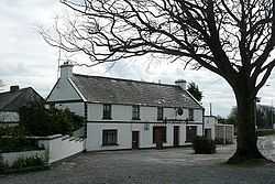
Turloughmore
| Turloughmore an Turlach Mór | |
|---|---|
| Town | |
 | |
 Turloughmore Location in Ireland | |
| Coordinates: 53°22′29″N 8°51′53″W / 53.3747°N 8.8647°WCoordinates: 53°22′29″N 8°51′53″W / 53.3747°N 8.8647°W | |
| Country | Ireland |
| Province | Connacht |
| County | County Galway |
| Elevation | 26 m (85 ft) |
| Time zone | WET (UTC+0) |
| • Summer (DST) | IST (WEST) (UTC-1) |
| Irish Grid Reference | M424370 |
Turloughmore (/tɜrlɒxˈmoʊr/ tur-lokh-MOHR; Irish: an Turlach Mór, meaning "big lake") is a village in County Galway, Ireland. The name means "the large lake," a notable feature of the area, together with the Clare River (Abhainn an Chláir).
It is a small village consisting of two petrol stations, three pubs and the base of a large bus service. The expansion of Galway city is bringing it closer to the urban boundary, with a consequent increase in population and jobs. It is on the N63 national secondary road.
The village was once famous for the horse fair held there, and infamous for its faction-fighting (see John Callaghan (Galway). The village represents a long-established settlement with a medieval history, and is near the site of the Battle of Knockdoe (Irish Cath Chnoc Tua), a bloody conflict in 1504 between some of the most powerful magnates of the time.[1][2]
See also
References
- ↑ Annála Ríochta Éireann (Annals of the Four Masters), M1504.13, M1504.14: http://www.ucc.ie/celt/published/G100005D/index.html
- ↑ McCollough (ed.), Wars of the Irish Kings, pp. 239-244.
Books
- Blackmore, Liz, John Cronin, Donal Ferrie and Brid Higgins (ed.), 2001. In Their Own Words: The Parish of Lackagh-Turloughmore and its People. Galway. ISBN 0-9539834-0-4
- McCollough, David W. (eag.), 2000. Wars of the Irish Kings: A Thousand Years of Struggle, from the Age of Myth through the Reign of Queen Elizabeth 1. Crown Publishing Group. ISBN 978-1-4028-9562-3 / ISBN 1-4028-9562-3