Tupinambarana
| Native name: <span class="nickname" ">Ilha Tupinambarana | |
|---|---|
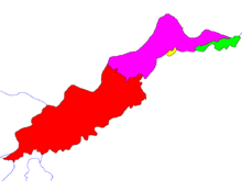 The four islands of Ilha Tupinambarana | |
 Tupinambarana (Brazil) | |
| Geography | |
| Location | State of Amazonas, Brazil |
| Coordinates | 3°00′S 58°00′W / 3.000°S 58.000°W |
| Area | 11,850 km2 (4,580 sq mi) |
| Area rank | 66th |
| Country | |
| State | Amazonas |
| Largest settlement | Parintins (pop. 109,150) |
Ilha Tupinambarana is the name of a former fluvial island bordered by rivers of the Amazon system (Amazon, Madeira, Sucunduri, and Abacaxis) in eastern Amazonas, Brazil. Today, it has been split into four completely separate parts by natural channels, just like those isolating it from the mainland—it is no longer one island, but four. The original island stretched from the municipalities of Parintins, in the northeast, to Nova Olinda do Norte, in the southwest. The combined area of the islands is to 11,850 km², making Ilha Tupinambarana the second largest fluvial group of islands in the world after Bananal Island.