Tublay, Benguet
| Tublay | ||
|---|---|---|
| Municipality | ||
| ||
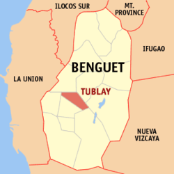 Location in the province of Benguet | ||
.svg.png) Tublay Location within the Philippines | ||
| Coordinates: 16°31′N 120°37′E / 16.517°N 120.617°ECoordinates: 16°31′N 120°37′E / 16.517°N 120.617°E | ||
| Country |
| |
| Region | Cordillera Administrative Region (CAR) | |
| Province | Benguet | |
| District | Lone district of Benguet | |
| Barangays | 8 | |
| Government | ||
| • Mayor | Ruben Eque Paoad | |
| Area[1] | ||
| • Total | 102.55 km2 (39.59 sq mi) | |
| Population (2010)[2] | ||
| • Total | 16,555 | |
| • Density | 160/km2 (420/sq mi) | |
| Time zone | PST (UTC+8) | |
| ZIP code | 2615 | |
| Dialing code | 74 | |
| Income class | 5th class | |

Tublay is a fifth class municipality in the province of Benguet, Philippines. According to the 2010 census, it had a population of 16,555 people.[2]
History
Tublay began as a township organized by the American government in November 1900.
Geography
Tublay is bounded by Kapangan on the north, Atok on the east, Itogon and Bokod on the southeast, La Trinidad on the west, and Sablan on the northwest.
The municipality is located 263 kilometres (163 mi) north of Manila and 13 kilometres (8.1 mi) north of Baguio City.
The topography is generally mountainous with an elevation of 1,400 metres (4,600 ft) above sea level. It has two pronounced seasons - the dry and the wet seasons with a temperature coldest at 6.5 °C (43.7 °F) and warmest at 27.5 °C (81.5 °F).
Barangays
| Rank | Barangay | Population | Rank | Barangay | Population | |
|---|---|---|---|---|---|---|
| 1 | Ambassador | 4,799 | 6 | Ambongdolan | 980 | |
| 2 | Caponga (Poblacion) | 4,049 | 7 | Tuel | 960 | |
| 3 | Daclan | 1,937 | 8 | Tublay Central | 896 | |
| 4 | Ba-ayan | 1,736 | Tublay Total | 16,555 | ||
| 5 | Basil | 1,198 | ||||
*Italicized names are former names
Ambassador is the largest barangay in terms of land area (11.52 km²), while Tuel is the smallest (4.79 km²).
Demographics
| Population census of Tublay | ||
|---|---|---|
| Year | Pop. | ±% p.a. |
| 1990 | 11,479 | — |
| 1995 | 13,263 | +2.74% |
| 2000 | 13,672 | +0.65% |
| 2007 | 15,096 | +1.38% |
| 2010 | 16,555 | +3.41% |
| Source: National Statistics Office[2][4] | ||
Education
Public schools
As of 2014, Tublay has 19 public elementary schools and 2 public secondary schools.[5][6][7]
|
|
References
- ↑ "Province: Benguet". PSGC Interactive. Makati City, Philippines: National Statistical Coordination Board. Retrieved 12 August 2013.
- ↑ 2.0 2.1 2.2 "Total Population by Province, City, Municipality and Barangay: as of May 1, 2010". 2010 Census of Population and Housing. National Statistics Office. Retrieved 12 August 2013.
- ↑ "2010 Census of Population and Housing: Population Counts - Cordillera Administrative Region" (PDF). National Statistics Office (Philippines), April 4, 2012. Retrieved 16 November 2014.
- ↑ "Province of Benguet". Municipality Population Data. LWUA Research Division. Retrieved 12 August 2013.
- ↑ "Masterlist of Public Elementary Schools for the School year 2012- 2013" (XLSX). Department of Education (Philippines), July 15, 2013. Retrieved 28 December 2014.
- ↑ 6.0 6.1 "Masterlist of Secondary Schools (School Year 2013- 2014)" (XLSX). Department of Education (Philippines), July 4, 2013. Retrieved 20 November 2014.
- ↑ 7.0 7.1 "Masterlist of Public Schools SY 2013-2014" (XLSX). Department of Education (Philippines), 22 October 2014. Retrieved 28 December 2014.
External links
 |
Sablan | Kapangan | | |
| La Trinidad | |
Atok | ||
| ||||
| | ||||
| Itogon | Bokod |
| ||||||||||||||||||