Tubay, Agusan del Norte
| Tubay | ||
|---|---|---|
| Municipality | ||
| ||
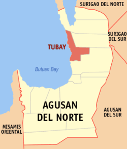 Map of Agusan del Norte with Tubay highlighted | ||
.svg.png) Tubay Location within the Philippines | ||
| Coordinates: 09°10′N 125°32′E / 9.167°N 125.533°ECoordinates: 09°10′N 125°32′E / 9.167°N 125.533°E | ||
| Country | Philippines | |
| Region | Caraga (Region XIII) | |
| Province | Agusan del Norte | |
| District | 2nd district of Agusan del Norte | |
| Barangays | 13 | |
| Government[1] | ||
| • Mayor | Fidel E. Garcia Jr. | |
| Area[2] | ||
| • Total | 138.09 km2 (53.32 sq mi) | |
| Population (2010)[3] | ||
| • Total | 20,426 | |
| • Density | 150/km2 (380/sq mi) | |
| Time zone | PST (UTC+8) | |
| ZIP code | 8606 | |
| Dialing code | 85 | |
| Income class | 4th | |
| Website |
tubayagusan wordpress | |

Tubay is a fourth class municipality in the province of Agusan del Norte, Philippines. According to the 2010 census, it has a population of 20,426 people.[3]
It was created from the barrios of Tubay, La Fraternidad, Tinigbasan, Cabayawa, Victory, Sta. Ana, and Tagmamarcay of the municipality of Cabadbaran, Agusan del Norte in 1947, by virtue of Republic Act No. 188.
Barangays
Tubay is politically subdivided into 13 barangays.[2]
- Binuangan
- Cabayawa
- Doña Rosario
- Doña Telesfora
- La Fraternidad
- Lawigan
- Poblacion 1
- Poblacion 2
- Santa Ana
- Tagmamarkay
- Tagpangahoy
- Tinigbasan
- Victory
History
The town of Tubay is named after its legendary founder Datu Tabay, and lays claim to being the second Spanish Settlement in Agusan and was known as a Pueblo as early as 1751. Formerly, the people settled in the wilderness of Ilihan, then transferred to sitio Malabog and later to Tubay-Tubay and Sabang near the mouth of the Jabonga River. However, the danger of constant inundation and Moro attacks convinced the succeeding leader of the place to move the pueblo to Daang Lungsod where the massive magkuno post of once spacious and strongly built church now stand. It was here where the settlement firmly took place.
Since 1898, Tubay was a prosperous town. But when the Americans visited Tubay and Cabadbaran, they were convinced that the latter was the better place for the seat of government. Therefore in 1903, Tubay was reduced to a barrio to give way to its equally thriving neighbor, Cabadbaran. Although reduced to a barrio status, it still remained the center of commercial activity due to the presence of Chinese merchants. Booming business in Tubay was still noticeable until the fabulous 20’s when the navigable Jabonga River was the chief artery of its copra and hemp traffic. However, when the road connecting Tubay-Santiago and Cabadbaran was finished, business in Tubay began to decline and trade through the Jabonga River disappeared.
On June 22, 1947, the Congress of the Philippines enacted Republic Act No. 188 which created (or more properly, recreated) the town of Tubay.[4] By virtue of said law, President Manuel A. Roxas issued Presidential Proclamation No. 44 on October 20, 1947, thus making Tubay regain its township status.[5]
Demographics
| Population census of Tubay | ||
|---|---|---|
| Year | Pop. | ±% p.a. |
| 1990 | 15,248 | — |
| 1995 | 16,672 | +1.69% |
| 2000 | 17,668 | +1.25% |
| 2007 | 18,674 | +0.77% |
| 2010 | 20,426 | +3.32% |
| Source: National Statistics Office[3] | ||
References
- ↑ "Official City/Municipal 2013 Election Results". Intramuros, Manila, Philippines: Commission on Elections (COMELEC). 1 July 2013. Retrieved 5 September 2013.
- ↑ 2.0 2.1 "Province: AGUSAN DEL NORTE". PSGC Interactive. Makati City, Philippines: National Statistical Coordination Board. Retrieved 7 April 2014.
- ↑ 3.0 3.1 3.2 "Total Population by Province, City, Municipality and Barangay: as of May 1, 2010". 2010 Census of Population and Housing. National Statistics Office. Retrieved 1 April 2014.
- ↑ "An act creating the municipality of Tubay, province of Agusan". LawPH.com. n.d. Retrieved 2011-04-08.
- ↑ Municipality of Tubay (2010-01-11). "History Of Tubay". Retrieved 2010-09-15.
External links
 |
Jabonga | Santiago | | |
| Bohol Sea | |
Cabadbaran | ||
| ||||
| | ||||
| Butuan Bay | Cabadbaran |
| ||||||||||||||||||