Tsukubamirai, Ibaraki
| Tsukubamirai つくばみらい市 | ||
|---|---|---|
| City | ||
| ||
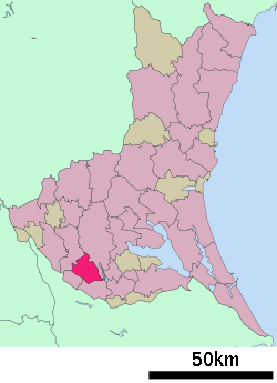 Location of Tsukubamirai in Ibaraki Prefecture | ||
 Tsukubamirai Location in Japan | ||
| Coordinates: 35°58′N 140°2′E / 35.967°N 140.033°ECoordinates: 35°58′N 140°2′E / 35.967°N 140.033°E | ||
| Country | Japan | |
| Region | Kantō | |
| Prefecture | Ibaraki Prefecture | |
| Government | ||
| • Mayor | Masao Kataniwa (since May 2010) | |
| Area | ||
| • Total | 79.14 km2 (30.56 sq mi) | |
| Population (January 1, 2012) | ||
| • Total | 46,185 | |
| • Density | 580/km2 (1,500/sq mi) | |
| Time zone | Japan Standard Time (UTC+9) | |
| Symbols | ||
| - Tree | Cherry blossom | |
| - Flower | Brassica napus | |
| - Bird | Skylark | |
| Address |
Fukuda 195, Tsukubamirai City, Ibaraki Prefecture (茨城県つくばみらい市福田195号) 300-2395 | |
| Phone number | 81(0)297-58-2111 | |
| Website | City of Tsukubamirai | |

Tsukubamirai (つくばみらい市 Tsukubamirai-shi) is a city located in Ibaraki Prefecture, Japan.
The modern city of Tsukubamirai was established on March 27, 2006, from the merger of the town of Ina, and the village of Yawara (both from Tsukuba District).
As of January 1, 2012 population data, the city has an estimated population of 46,185, with 16,913 households and a population density of 583.59 persons per km². The total area is 79.14 km².
Tourist attractions
External links
![]() Media related to Tsukubamirai, Ibaraki at Wikimedia Commons
Media related to Tsukubamirai, Ibaraki at Wikimedia Commons
- Tsukubamirai City official website (Japanese)
| ||||||||||||||||||||||||||||||||||||