Tsaghkalanj
Coordinates: 40°12′00″N 44°13′39″E / 40.20000°N 44.22750°E
| Tsaghkalanj Ծաղկալանջ | |
|---|---|
 Tsaghkalanj Ծաղկալանջ | |
| Coordinates: 40°12′00″N 44°13′39″E / 40.20000°N 44.22750°E | |
| Country | Armenia |
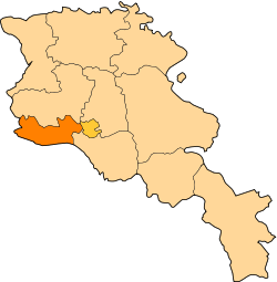
| Marz (Province) | Armavir |
| Population (2008) | |
| • Total | 1,321 |
| Time zone | (UTC+4) |
| • Summer (DST) | (UTC+5) |
Tsaghkalanj (Armenian: Ծաղկալանջ, also Romanized as Tsakhkaladzh; until 1978, Agdzhakala and Aghjaghala) is a town in the Armavir Province of Armenia. The town's church, dedicated to Saint Gevorg, dates to the 1870s. There is a neolithic-chalcolithic tell in the village and there are Bronze Age grave mounds nearby. Amenaprkich, a disused medieval settlement is also nearby.
References
- Tsaghkalanj at GEOnet Names Server
- World Gazeteer: Armenia – World-Gazetteer.com
- Report of the results of the 2001 Armenian Census, National Statistical Service of the Republic of Armenia
- Kiesling, Brady (2005), Rediscovering Armenia: Guide, Yerevan, Armenia: Matit Graphic Design Studio
- Brady Kiesling, Rediscovering Armenia, p. 36; original archived at Archive.org, and current version online on Armeniapedia.org.