Trussville, Alabama
| Trussville | ||
|---|---|---|
| City | ||
 | ||
| ||
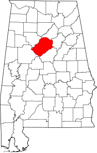
 Location in Jefferson County and the state of Alabama | ||
| Coordinates: 33°37′18″N 86°35′47″W / 33.62167°N 86.59639°W | ||
| Country | United States | |
| State | Alabama | |
| Counties | Jefferson, St. Clair | |
| Government | ||
| • Mayor | Gene Melton | |
| Area | ||
| • City | 22.3 sq mi (57.6 km2) | |
| • Land | 22.2 sq mi (57.4 km2) | |
| • Water | 0.1 sq mi (0.2 km2) | |
| Elevation | 699 ft (213 m) | |
| Population (2013) | ||
| • City | 20,368 | |
| • Density | 897.9/sq mi (347.3/km2) | |
| • Metro | [1] | |
| Time zone | Central (CST) (UTC-6) | |
| • Summer (DST) | CDT (UTC-5) | |
| ZIP code | 35173 | |
| Area code(s) | 205 | |
| FIPS code | 01-76944 | |
| GNIS feature ID | 0153729 | |
| Website | http://www.trussville.org/ | |

Trussville is a city in Jefferson and St. Clair counties in the State of Alabama. A suburb of Birmingham, Trussville's population was 19,933 at the 2010 census.
Geography
Trussville is located at 33°37′18″N 86°35′47″W / 33.62167°N 86.59639°W (33.621623, -86.596404).[2]
According to the United States Census Bureau, the city has a total area of 22.2 square miles (57 km2), of which 22.2 square miles (57 km2) is land and 0.1 square miles (0.26 km2) (0.27%) is water.
Demographics
| Historical population | |||
|---|---|---|---|
| Census | Pop. | %± | |
| 1950 | 1,575 | — | |
| 1960 | 2,510 | 59.4% | |
| 1970 | 2,985 | 18.9% | |
| 1980 | 3,507 | 17.5% | |
| 1990 | 8,266 | 135.7% | |
| 2000 | 12,924 | 56.4% | |
| 2010 | 19,933 | 54.2% | |
| Est. 2013 | 20,368 | 2.2% | |
| U.S. Decennial Census[3] 2013 Estimate[4] | |||
In 2010 the United States Census Bureau listed the Trussville population as 19,993, making it one of the fastest growing cities in Jefferson County and Alabama.
As of the census of 2000, there were 12,924 people, 4,588 households, and 3,817 families residing in the city. The population density was 582.7 people per square mile (225.0/km²). There were 4,726 housing units at an average density of 213.1 per square mile (82.3/km²). The racial makeup of the city was 96.77% White, 1.48% Black or African American, 0.32% Native American, 0.43% Asian, 0.01% Pacific Islander, 0.37% from other races, and 0.62% from two or more races. 0.84% of the population were Hispanic or Latino of any race.
There were 4,588 households out of which 42.2% had children under the age of 18 living with them, 73.3% were married couples living together, 7.6% had a female householder with no husband present, and 16.8% were non-families. 15.3% of all households were made up of individuals and 7.0% had someone living alone who was 65 years of age or older. The average household size was 2.79 and the average family size was 3.11.
In the city the population was spread out with 27.4% under the age of 18, 6.2% from 18 to 24, 28.5% from 25 to 44, 26.1% from 45 to 64, and 11.7% who were 65 years of age or older. The median age was 38 years. For every 100 females there were 94.9 males. For every 100 females age 18 and over, there were 90.8 males.
The median income for a household in the city was $66,943, and the median income for a family was $71,111. Males had a median income of $48,921 versus $31,806 for females. The per capita income for the city was $27,235. About 2.5% of families and 3.5% of the population were below the poverty line, including 3.6% of those under age 18 and 3.2% of those age 65 or over.
History
The first European settler to establish residence in the area was Warren Truss, who entered the area on the Georgia Road with his brothers Joel and Sam Jr, and constructed a grist mill on the Cahaba River in 1821.
Trussville remained an agricultural community until after the Civil War when the Alabama-Chattanooga Railway was built through the city. By 1886 a blast furnace was built where the current Hewitt-Trussville Middle School now stands.
During the 1930s, Franklin D. Roosevelt's Government Resettlement Administration constructed the Cahaba Homestead Village or as it was locally called the "Slagheap Village" in the area directly west of downtown. Each of these residences was leased by the federal government until being sold to private landowners in 1947.[5]
On June 10, 1947, Trussville was incorporated as a town, and on May 31, 1957, the town officially became a city. It was on this date the City of Trussville was adopted as the official name.[6]
Today Trussville is one of the Birmingham region's most rapidly growing areas. The city has seen much residential and retail construction with two major shopping centers being built within the city during the early 2000s, the Colonial Promenade at Trussville on its western side and both the Colonial Promenade Tutwiler Farm and Pinnacle at Tutwiler Farm along Highway 11 at the I-59/I-459 interchange.
Education
Trussville's public schools are operated by the Trussville City Schools.[7]
Media
The local newspaper is The Trussville Tribune. The Tribune, which covers crime, government, sports and community events in Trussville, Clay and Pinson, is published each Wednesday and provides news online.
Notable people
- John Amari, judge and former member of both houses of the Alabama State Legislature, resident of Trussville and native of Jefferson County
- Jay Barker, former quarterback for the University of Alabama
- Brandon Cox, American football player
- Matt Dickey, professional basketball player
- Mike Mordecai, former Major League Baseball player
- Robert J. Natter, United States Navy Admiral
References
- ↑ "Population Estimates". United States Census Bureau. Retrieved 2014-06-07.
- ↑ "US Gazetteer files: 2010, 2000, and 1990". United States Census Bureau. 2011-02-12. Retrieved 2011-04-23.
- ↑ United States Census Bureau. "Census of Population and Housing". Retrieved August 10, 2013.
- ↑ "Annual Estimates of the Resident Population: April 1, 2010 to July 1, 2013". Retrieved June 7, 2014.
- ↑ http://www.archives.state.al.us/markers/ijefferson.html
- ↑ http://www.trussville.org/historical/index.html
- ↑ Trussville City Schools
External links
Coordinates: 33°37′18″N 86°35′47″W / 33.621623°N 86.596404°W
| |||||||||||||||||||||||||||||
| |||||||||||||||||||||||||
