Troodos Mountains
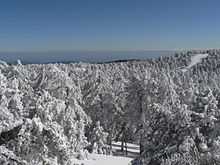
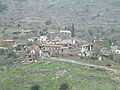
Troodos (Greek: Τρόοδος [ˈtɾooðos]; Turkish: Trodos Dağları) is the largest mountain range in Cyprus, located in the center of the island. Troodos' highest peak is Mount Olympus at 1,952 meters which also hosts 4 ski slopes. The Troodos mountain range stretches across most of the western side of Cyprus. There are many famous mountain resorts, Byzantine monasteries and churches on mountain peaks, and nestling in its valleys and picturesque mountains are villages clinging to terraced hill slopes. The area has been known since ancient times for its mines, and in the Byzantine period it became a great centre of Byzantine art, as churches and monasteries were built in the mountains, away from the threatened coastline.
Geology of Troodos
_-_TIMEA.jpg)

The Troodos mountains are known worldwide for their geology and the presence of undisturbed specimens of ophiolite, the Troodos Ophiolite. These mountains slowly rose from the sea due to the collision of the African and European tectonic plates, a process that eventually formed the island of Cyprus. The slowing and near-cessation of this process left the rock formations near intact, while subsequent erosion uncovered the magma chamber underneath the mountain, allowing a viewing of intact rocks and petrified pillow lava formed millions of years ago, an excellent example of ophiolite stratigraphy. The observations of the Troodos ophiolite by Ian Graham Gass and co-workers was one of the key points that led to the theory of sea floor spreading.
Climate
| Climate data for Prodromos in Troödos Mountains, elevation: 1380 m (Satellite view) | |||||||||||||
|---|---|---|---|---|---|---|---|---|---|---|---|---|---|
| Month | Jan | Feb | Mar | Apr | May | Jun | Jul | Aug | Sep | Oct | Nov | Dec | Year |
| Average high °C (°F) | 6.3 (43.3) |
6.6 (43.9) |
10.3 (50.5) |
15.1 (59.2) |
20.5 (68.9) |
25.0 (77) |
28.1 (82.6) |
27.9 (82.2) |
24.4 (75.9) |
19.6 (67.3) |
12.8 (55) |
8.0 (46.4) |
17.1 (62.8) |
| Daily mean °C (°F) | 3.5 (38.3) |
3.5 (38.3) |
6.6 (43.9) |
10.7 (51.3) |
15.8 (60.4) |
20.1 (68.2) |
23.3 (73.9) |
23.1 (73.6) |
19.6 (67.3) |
15.4 (59.7) |
9.5 (49.1) |
5.3 (41.5) |
13.0 (55.4) |
| Average low °C (°F) | 0.7 (33.3) |
0.3 (32.5) |
2.8 (37) |
6.3 (43.3) |
11.1 (52) |
15.2 (59.4) |
18.4 (65.1) |
18.2 (64.8) |
14.9 (58.8) |
11.3 (52.3) |
6.2 (43.2) |
2.5 (36.5) |
9.0 (48.2) |
| Average precipitation mm (inches) | 133.4 (5.252) |
123.6 (4.866) |
82.3 (3.24) |
56.9 (2.24) |
26.0 (1.024) |
40.0 (1.575) |
12.1 (0.476) |
10.0 (0.394) |
9.5 (0.374) |
24.0 (0.945) |
102.5 (4.035) |
169.7 (6.681) |
790.1 (31.106) |
| Avg. precipitation days (≥ 1 mm) | 12.4 | 11.2 | 9.8 | 6.7 | 3.7 | 2.1 | 0.7 | 0.7 | 1.4 | 3.5 | 7.4 | 11.2 | 70.7 |
| Mean monthly sunshine hours | 130.2 | 150.8 | 195.3 | 231.0 | 275.9 | 315.0 | 328.6 | 310.0 | 255.0 | 220.1 | 165.0 | 136.4 | 2,713.3 |
| Source: Meteorological Service (Cyprus)[1] | |||||||||||||
Churches
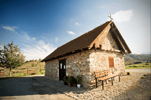
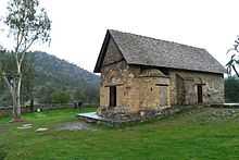
The region is known for its many Byzantine churches and monasteries, richly decorated with murals, of which the Kykkos monastery is the richest and most famous. Nine churches and one monastery in Troodos together form a World Heritage Site, originally inscribed on the World Heritage List by UNESCO in 1985. The nine Byzantine churches are:
- Stavros tou Ayiasmati
- Panayia tou Araka
- Timiou Stavrou at Pelendri
- Ayios Nikolaos tis Stegis
- Panayia Podithou
- Assinou
- Ayios loannis Lampadistis at Kalopanayiotis
- Panayia tou Moutoula
- Archangel Michael at Pedoulas
- Transfiguration of the Saviour Palaichori
The area has been known since ancient times for its copper mines, and in the Byzantine period it became a great centre of Byzantine art, as churches and monasteries were built in the mountains, away from the threatened coastline.
-

Interior View of Kykkos Monastery
-

Church in spring
Villages of Troodos (selection)

|
Gallery
-
January in Troodos
-

Young tree in Winter
-
.jpg)
Troodos Mountains
-
Lazanias village
-
Troodos has many of the oldest trees in the world
-
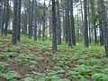
Forests in Troodos Mountains
-

Pinus brutia, foothills of Troodos Mountains
-
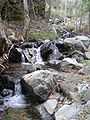
River tributary in Troodos
-

Parakentro is a non-profit cultural centre in Lemythou village
-
Millomeris Waterfall, Platres
-
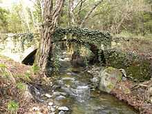
Milia Bridge, Platres
-
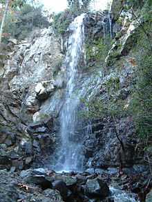
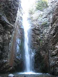
Kalidonia Waterfall, Platres
-
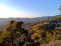
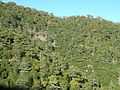
Part of Troodos Mountains.
-
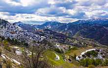
View from Farmakas