Tromelin Island
Coordinates: 15°53′32″S 54°31′29″E / 15.89222°S 54.52472°E
| Tromelin Island Île Tromelin
|
||||
|---|---|---|---|---|
|
||||
| Motto: "Liberté, égalité, fraternité" | ||||
| Anthem: La Marseillaise | ||||
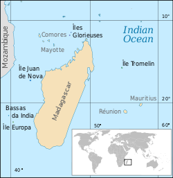 Location of the Scattered islands in the Indian Ocean.
KM=Comoros MG=Madagascar MU=Mauritius MZ=Mozambique RE=Réunion YT=Mayotte |
||||


Tromelin Island (/ˌtroʊmlɪn ˈaɪlənd/; French: Île Tromelin, pronounced: [il tʁɔmlɛ̃]) is a low, flat, island in the Indian Ocean, about 450 kilometres (280 mi) east of Madagascar. It is administered as a French overseas territory, as the result of an agreement with the United Kingdom in 1954, but sovereignty is disputed with ownership claimed by both Mauritius and the Seychelles.[1] It has a weather station and is a nesting site for boobies and green sea turtles.
Description
Very much like a large sandbank and only 7 metres (23 ft) high at its highest point, Tromelin is about 1,700 metres (1.1 mi) long and 700 metres (0.43 mi) wide, with an area of 80 ha (200 acres), covered in scrub dominated by Octopus Bush[2] and surrounded by coral reefs. There are no harbours or anchorages, so that access by sea is difficult. A 1,200-metre (3,900 ft) airstrip provides the island's link with the outside world.
Important Bird Area
The island has been identified as an Important Bird Area (IBA) by BirdLife International because of its significance as a seabird breeding site. Both Masked (with up to 250 pairs) and Red-footed Boobies (up to 180 pairs) nesting there. Sulidae populations have seriously declined in the western Indian Ocean with those on Tromelin among the healthiest remaining. The island’s Masked Boobies are of the western Indian Ocean subspecies (Sula dactylatra melanops), of which Tromelin is a stronghold. The Red-footed Boobies constitute the only polymorphic population in the region, indicating its biogeographical isolation. Both Great and Lesser Frigatebirds used to nest on the island but have subsequently become extinct as breeders, though they continue to use the island for roosting. There are no resident landbirds.[2]
History

The island was first recorded by a French navigator, Jean Marie Briand de la Feuillée, in 1722 and initially named Île des Sables.[3]
In 1761 the French ship Utile, carrying slaves from Madagascar to Mauritius, ran onto the reefs of the island. The crew reached Madagascar in a raft, abandoning some 60 slaves on the desert island. Fifteen years later in 1776, Bernard Boudin de Tromelin (from whom the island takes its name), captain of the French warship La Dauphine, visited the island and rescued the survivors—seven women and an eight-month-old child.[4]
French claims date back to 1810.[5] However, from the 19th century until the 1950s, Tromelin was a dependency of the British colony of Mauritius. In 1954, by an agreement between the British and the French, France constructed a meteorological station and a landing strip on the island.[6] It is a matter of dispute whether the agreement transferred sovereignty of Tromelin from one to the other, and Mauritius claims the island as part of its territory on the grounds that sovereignty was not transferred to France and the island was thus part of the colony of Mauritius at the time of independence.[7] Indeed, as early as 1959, even before independence, Mauritius informed the World Meteorological Organization that it considered Tromelin to be part of its territory.[8] France and Mauritius reached a co-management treaty in 2010.[9]
Tromelin has an Exclusive Economic Zone (EEZ) of 280,000 square kilometres (110,000 sq mi), contiguous with that of Réunion. The island's weather station, which warns of cyclones, is still operated by France and is staffed by meteorologists from Réunion.
Amateur Radio
The first amateur radio operation from Tromelin Island took place in 1954, by Marc FB8BK/T. A major operation took place in 2000 by a 4-man team who made 50,000 contacts with the callsign FR/F6KDF/T. Authorization was not given again until 2014, so by August 2014, Clublog listed Tromelin Island as the eighth most-wanted DXCC entity.[10] A DX-pedition consisting of seven French radio amateurs arrived and operated from Tromelin Island from October 30 to November 10, 2014 using call sign FT4TA.,[11] making 71,465 contacts.
References
- ↑ "Seychelles has claim on Glorieuses and Tromelin, says historian Durup". Seychelles eNews. 2012-09-30. Retrieved 2014-01-03.
- ↑ 2.0 2.1 BirdLife International. (2012). Important Bird Areas factsheet: Tromelin. Downloaded from http://www.birdlife.org on 2012-01-07.
- ↑ http://ifm.free.fr/htmlpages/pdf/2007/477-4-esclaves.pdf
- ↑ Marriner, N.; Guérout, M.; Romon, T. (2010). "The Forgotten Slaves of Tromelin (Indian Ocean): New Geoarchaeological Data". Journal of Archaeological Science 37 (6): 1293–1304. doi:10.1016/j.jas.2009.12.032.
- ↑
- ↑ Charney, Jonathan I.; Colson, David A.; Alexander, Lewis M. (2005). International Maritime Boundaries. p. 3463. ISBN 9004144617.
- ↑ Forbes, Vivian Louis (1995). The maritime boundaries of the Indian Ocean region. Singapore University Press. p. 110. ISBN 9971691892.
- ↑ Rumley, Dennis; Chaturvedi, Sanjay; Sakhuja, Vijay (2010). Fisheries Exploitation in the Indian Ocean: Threats and Opportunities. p. 123. ISBN 9789812309860.
- ↑ "Tromelin : La Réunion, spectatrice et spoliée". Lequotidien.re.
- ↑ DXCC Most Wanted List
- ↑ Tromelin DxPedition - Oct 30th to Nov 10th 2014
External links
| Wikimedia Commons has media related to Tromelin. |
- The shipwrecked memory of the L'Utile slaves
- "Shipwrecked and abandoned: the story of the slave Crusoes" by John Lichfield, The Independent 5 February 2007
| |||||||||||||||||||||||||||||||||||||||||||||||||

| ||||||||||||||||||||||||||||||||||||||
| ||||||||||||||||||