Trinity Island
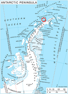 Location of Trinity Island. | |
| Geography | |
|---|---|
| Location | Antarctica |
| Coordinates | 63°47′S 60°44′W / 63.783°S 60.733°W |
| Archipelago | Palmer Archipelago |
| Length | 24 km (15 mi) |
| Width | 10 km (6 mi) |
| Country | |
|
None | |
| Demographics | |
| Population | 0 |
| Additional information | |
| Administered under the Antarctic Treaty System | |
Trinity Island or Île de la Trinité or Isla Trinidad is an island 24 km (15 mi) long and 10 km (6 mi) wide. It lies 37 km (23 mi) east of Hoseason Island in the northern part of the Palmer Archipelago, Antarctica. It was named by Otto Nordenskiöld, leader of the Swedish Antarctic Expedition (1901-1904) in commemoration of Edward Bransfield's "Trinity Land" of 1820.
Important Bird Areas
A 50 ha site comprising a rocky headland rising to 250 m, at the south-western extremity of the island, has been designated an Important Bird Area (IBA) by BirdLife International because it supports a breeding colony of about 200 pairs of imperial shags. Chinstrap penguins also nest at the site.[1] Another IBA on the island is Cape Wollaston at its north-western extremity.
See also
References
- ↑ "Trinity Island southwest". BirdLife data zone: Important Bird Areas. BirdLife International. 2013. Retrieved 2013-01-20.
Coordinates: 63°47′S 60°44′W / 63.783°S 60.733°W