Tri-Cities Airport (New York)
| Tri-Cities Airport | |||||||||||
|---|---|---|---|---|---|---|---|---|---|---|---|
| IATA: none – ICAO: KCZG – FAA LID: CZG | |||||||||||
| Summary | |||||||||||
| Airport type | Public | ||||||||||
| Owner | Village of Endicott | ||||||||||
| Serves | Endicott, New York | ||||||||||
| Elevation AMSL | 833 ft / 254 m | ||||||||||
| Coordinates | 42°04′43″N 076°05′47″W / 42.07861°N 76.09639°W | ||||||||||
| Runways | |||||||||||
| |||||||||||
| Statistics (2008) | |||||||||||
| |||||||||||
Tri-Cities Airport (ICAO: KCZG, FAA LID: CZG) is a village-owned, public-use airport located three nautical miles (6 km) southwest of the central business district of Endicott, a village in Broome County, New York, United States.[1] According to the FAA's National Plan of Integrated Airport Systems for 2009–2013, it is classified as a general aviation airport.[2]
Although many U.S. airports use the same three-letter location identifier for the FAA and IATA, this airport is assigned CZG by the FAA but has no designation from the IATA.[3]
Facilities and aircraft
Tri-Cities Airport covers an area of 230 acres (93 ha) at an elevation of 833 feet (254 m) above mean sea level. It has one runway designated 3/21 with an asphalt surface measuring 3,900 by 75 feet (1,189 × 23 m).[1]
For the 12-month period ending January 15, 2008, the airport had 48,200 aircraft operations, an average of 132 per day: 89% general aviation, 10% air taxi and <1% military. At that time there were 52 aircraft based at this airport: 86% single-engine, 6% multi-engine and 8% glider.[1]
History
The Tri-Cities Airport was the principal airport for the Endicott-Johnson City-Binghamton area from the 1930s through the early 1950s. In its early years, it had a passenger terminal building, control tower, and cafe. The tower and cafe have since been demolished, but the small terminal building still exists, although it has been abandoned for some years. The main hangar also built during the Works Progress Administration era has also been demolished in 2010. As the DC-3 era came to an end, larger passenger planes coming into service required longer runways and a new, larger Greater Binghamton Airport was built and commissioned in 1951. Tri-Cities Airport was planned in 1934 and began at its commissioning in 1936 with three gravel/unpaved runways of about 3,000 feet (910 m). Later in 1942, the east-west and northeast-southwest runways were paved. Runway 3-21 was 3,500 feet (1,100 m) long and 100 feet (30 m) wide, but later was lengthened in the mid-1980s to 3,900 feet (1,200 m) and the width was reduced to 75 feet (23 m). Also, the runway previously was accessed by taxiing aircraft on the grass to the west northwest side of the runway, but a parallel asphalt taxiway was added along with a few connector taxiways.
The east-west crosswind runway 9-27 was 3,200 feet (980 m) long and 100 feet (30 m) wide, but was abandoned around 1969 and now is used as a taxiway along a portion of its length and aircraft parking can be conducted there.
A section of grass on the opposite side (east) from the parallel taxiway is used by gliders for landings and for tow operations for takeoff.
An Automated Weather Observing System (AWOS-3) was installed to provide current weather information to pilots.
Airport lighting
Runway 3-21 is equipped with medium intensity runway edge lighting. Both runway ends have runway end identifier lights. Runway 21 is equipped with precision approach path indicators, having replaced the older VASIs.
The airport also has an airport beacon, but hills - especially the one to the north - can limit its ability to be viewed.
Instrument procedures
For many years a circling instrument approach has brought aircraft in from the north via the Binghamton VORTAC (about five miles (8 km) distant), but landing minimums were rather high as the aircraft were 1,227 feet (374 m) above the airport elevation (although DME-equipped aircraft can descend up to an additional 80 feet) and visibility required for the approach was about 1¼ miles for aircraft flying at 90 knots (170 km/h) or slower, but range up to 3 miles (4.8 km) for aircraft flying at more than 120 knots (220 km/h). Some historical procedures in the 1970s requiring around 1¾ miles visibility as an absolute minimum.
With the addition of GPS-based navigation, a straight-in instrument approach was approved for runway 21 and this has allowed operations with lower minimum descent altitude requirement of 887 feet (270 m) and visibility of 1¼ miles for those aircraft flying at 120 knots (220 km/h) or slower, but 2¾ mile visibility is needed for faster aircraft.
Weather factors
Being adjacent to the Susquehanna River, the airport experiences fog on a relatively frequent basis during the late night to mid morning hours during the late summer to autumn with visibilities often under one quarter mile.
Aeromation
Patrick and Anita Harris are doing business as Aeromation at CZG, Anita provides the public presence. Patrick is an engineer and pilot providing design, maintenance, and pilot services.
-
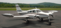
Cessna 30J N03018L
-
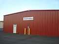
Red T Hangar at KCZG
References
- ↑ 1.0 1.1 1.2 1.3 FAA Airport Master Record for CZG (Form 5010 PDF). Federal Aviation Administration. Effective 8 April 2010.
- ↑ National Plan of Integrated Airport Systems for 2009–2013: Appendix A: Part 4 (PDF, 1.61 MB). Federal Aviation Administration. Updated 15 October 2008.
- ↑ "Tri-Cities Airport (IATA: none, ICAO: KCZG, FAA: CZG)". Great Circle Mapper. Retrieved 15 April 2010.
External links
- Diagram of Tri-Cities Airport (CZG) PDF from New York State DOT
- Aerial photo as of 27 March 1995 from USGS The National Map via MSR Maps
- FAA Terminal Procedures for CZG, effective April 2, 2015
- Resources for this airport:
- FAA airport information for CZG
- AirNav airport information for CZG
- FlightAware airport information and live flight tracker
- SkyVector aeronautical chart for CZG