Trevose, Pennsylvania
| Trevose, Pennsylvania | |
|---|---|
| Census-designated place | |
 Location of Trevose in Bucks County | |
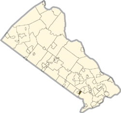
 Trevose Location of Trevose in Bucks County | |
| Coordinates: 40°08′21″N 74°58′52″W / 40.13917°N 74.98111°WCoordinates: 40°08′21″N 74°58′52″W / 40.13917°N 74.98111°W | |
| Country | United States |
| State | Pennsylvania |
| County | Bucks |
| Township | Lower Southampton |
| Area[1] | |
| • Total | 0.706 sq mi (1.83 km2) |
| • Land | 0.706 sq mi (1.83 km2) |
| • Water | 0 sq mi (0 km2) |
| Elevation | 128 ft (39 m) |
| Population (2010) | |
| • Total | 3,550 |
| • Density | 5,000/sq mi (1,900/km2) |
| Time zone | Eastern (EST) |
| • Summer (DST) | EDT (UTC) |
| GNIS feature ID | 1189750[2] |
| Designated | October 29, 1946[3] |
Trevose is a census-designated place of Bensalem and Lower Southampton Townships in Bucks County, Pennsylvania, United States, which is north of and borders northeastern Philadelphia.[2] Trevose was formerly part of Feasterville-Trevose, but was split into two separate CDPs for the 2010 census. U.S. 1 runs through the town as well as the Pennsylvania Turnpike, but Trevose's main road is Brownsville Road. As of the 2010 census, Trevose had a population of 3,550.[4]
The community is named after the home of settler Joseph Growden and itself after Growden's homestead in England (Growden was Cornish, Trevose is from the Cornish word Trenfos for farm.).[5]
See also
Notes
- ↑ "US Gazetteer files: 2010, 2000, and 1990". United States Census Bureau. 2011-02-12. Retrieved 2011-04-23.
- ↑ 2.0 2.1 "Trevose, Pennsylvania". Geographic Names Information System. United States Geological Survey.
- ↑ "PHMC Historical Markers Search" (Searchable database). Pennsylvania Historical and Museum Commission. Commonwealth of Pennsylvania. Retrieved 2014-01-25.
- ↑ "American FactFinder". United States Census Bureau. Retrieved 2011-05-14.
- ↑ Thomson, Jonathan P.. (2011-07-13) The History of Bensalem: Part I (1670 - 1770) - Around Town - Bensalem, PA Patch. Bensalem.patch.com. Retrieved on 2013-07-21.
