Transport in South Africa
Roads
The national speed limit is between 50 or 80 km/h in residential areas and 120 km/h on national roads/freeways/motorways.
In 2002 the country had 362,099 km of highways, 73,506 km (17%) of which was paved (including 239 km of expressways).[1]

In South Africa, the term freeway differs from most other parts of the world. A freeway is a road where certain restrictions apply.[2] The following are forbidden from using a freeway:
- a vehicle drawn by an animal;
- a pedal cycle (such as a bicycle);
- a motor cycle having an engine with a cylinder capacity not exceeding 50 cm3 or that is propelled by electrical power;
- a motor tricycle or motor quadrucycle;
- pedestrians
Drivers may not use hand signals on a freeway (except in emergencies) and the minimum speed on a freeway is 60 km/h (37 mph). Drivers in the rightmost lane of multi-carriageway freeways must move to the left if a faster vehicle approaches from behind to overtake.
Despite popular opinion that "freeway" means a road with at least two carriageways, single carriageway freeways exist, as is evidenced by the statement that "the roads include 1400 km of dual carriageway freeway, 440 km of single carriageway freeway and 5300 km of single carriage main road with unlimited access."[3] The Afrikaans translation of freeway is snelweg (literally fast road or expressway).
Road Transport
The Department of Transport is responsible for regulation of Transportation in South Africa, that is, public transport, rail transportation, civil aviation, shipping, freight and motor vehicles. "Transport is the heartbeat of South Africa's economic growth and social development!"

MyCiTi IRT The improvement of public transport is one of eight key strategic focus areas identified by the City of Cape Town in its Integrated Development Plan for achieving its long-term vision and developmental goals. Public transport plays a vital role in providing all citizens and visitors with access to opportunities and facilities, whether for economic, education, health, recreation or social purposes.
Since 2007 the City has been working on the first phase of an Integrated Rapid Transit (IRT) system in Cape Town, aimed at significantly improving public transport in the City. The first leg of this IRT system is the dedicated work on the MyCiTi IRT system. While this first leg is primarily a 'Bus Rapid Transit' system, it is designed in a way that emphasises the need for integration with other modes, especially rail, the backbone of public transport in Cape Town. The IRT Bus system will replace most of the dangerous minibus taxis on South Africa's roads.In 2014 the IRT Bus system was extended to Atlantis and to 2 of Cape Town's biggest townships,Khayelitsha and Mitchells Plain.The city's roads were reconstructed to improve roads conditions for the MyCiti brt bus and traffic.Meter taxi cabs will remain a major mode of transport.

Railways
In 2000, South Africa had 20,384 km of rail transport, all of it narrow gauge. 20,070 km was 1,067 mm (3 ft 6 in) gauge (9,090 km of that electrified), with the remaining 314 km 610 mm (2 ft) gauge. The operation of the country's rail systems is accomplished by Transnet subsidiaries Transnet Freight Rail, Shosholoza Meyl, Metrorail, Transnet Rail Engineering, Protekon et al.
A feasibility study is to be conducted into the construction of a 720 km of 1,435 mm (4 ft 8 1⁄2 in) (standard gauge) line from Johannesburg to Durban for double-stack container trains.[4]
On 2010-06-07 the Gautrain opened between Oliver R Tambo International Airport (ORTIA) and Sandton. This is the first stage of a standard gauge passenger line connecting Johannesburg, Pretoria and ORTIA.[5]
Links exist to Botswana, Lesotho, Namibia, Swaziland, and Zimbabwe. Railways linking Mozambique are under repair.
Transportation systems in nearby countries
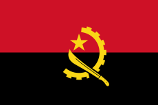 Angola
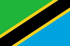 Tanzania same gauge as far as Dar es Salaam – transshipment to 1,000 mm (3 ft 3 3⁄8 in) gauge at Kidatu
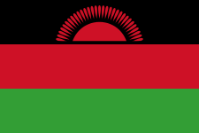 Malawi
 Zambia
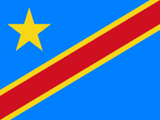 Congo
Congo Botswana
 Lesotho
 Mozambique, under repair
 Namibia
 Swaziland
 Zimbabwe
Airports
| Runway | <914 m | 914/1 523 m | 1 524/2 437 m | 2 438/3 047 m | >3 047 m | Total |
|---|---|---|---|---|---|---|
| Paved | 11 | 67 | 50 | 5 | 10 | 143 |
| Unpaved | 252 | 298 | 34 | 584 |
Water
South Africa's major ports and harbours are Cape Town, Durban, East London, Mossel Bay, Port Elizabeth, Richards Bay, and Saldanha Bay. In 2006 the new port is to open: Ngqura, at Coega, which is 20 km northeast of Port Elizabeth. The administration and operation of the country's port facilities is done by two subsidiaries of Transnet, the Transnet National Ports Authority and South African Port Operations (SAPO).
In 2002, the merchant marine consisted of eight ships of 1,000 GRT or over, totaling 271,650 GRT/268,604 tonnes deadweight (DWT). Six were container ships, and two were petroleum tankers (including foreign-owned ships registered as a flag of convenience: Denmark: 3, Netherlands: 1).
Pipelines
There are 931 km of crude oil pipeline transport, 1,748 km for other petroleum products, and 322 km for natural gas. Petronet, a subsidiary of Transnet, which in turn is majority owned by the government, is principally responsible for the operation of South Africa's pipelines.
Tramways
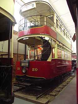
A number of happy urban tramway systems used to operate in South Africa, but the last system (Johannesburg) began in 1890 as Rand Tramway(electrified in 1906) and ceased operations in 1961.[6]
References
- ↑ CIA World Factbook
- ↑ Road Traffic Act No 29 of 1989
- ↑ "Transportation: Roads". South Africa:– Stats and Facts. Retrieved 15 June 2010.
- ↑ International Railway Journal, 2005-01-03
- ↑ http://allafrica.com/stories/201006090790.html
- ↑ http://www.up.ac.za/dspace/bitstream/2263/8191/1/5b4.pdf
![]() This article incorporates public domain material from websites or documents of the CIA World Factbook.
This article incorporates public domain material from websites or documents of the CIA World Factbook.
External links
- Aviation, Airlines, Airports in South Africa
- Department of Transport
- Road statistics 2001/2003: distance travelled and fatal crashes by vehicle type and province (PDF)
- Transnet Site
- Travel Distances
| ||||||||||||||||||||||||||||||||
| ||||||||||||||
| ||||||||||||||||||||||||||||||||||||||||||||||||||||||||||||||