Transport in Malaysia
 Life in Malaysia |
|---|
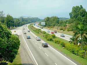

Transport in Malaysia started to develop during British colonial rule, and the country's transport network is now diverse and developed. Malaysia's road network is extensive, covering 144,403 km, including 1,821 km of expressways. The main highway of the country extends over 800 km, reaching the Thai border from Singapore. The network of roads in Peninsular Malaysia is of high quality, whilst the road system in East Malaysia is not as well developed. The main modes of transport in Peninsular Malaysia include buses, trains, cars and to an extent, commercial travel on aeroplanes.
Malaysia has six international airports. The official airline of Malaysia is Malaysia Airlines, providing international and domestic air service alongside two other carriers. Most of the major cities are connected by air routes. The railway system is state-run, and covers a total of 1,849 km. Popular within the cities is Light Rail Transit, which reduces the traffic load on other systems, and is considered safe, comfortable and reliable.
Land
Roads
Malaysia's road network covers 144,403 kilometres (89,728 mi), of which 116,169 kilometres (72,184 mi) is paved, and 1,821 kilometres (1,132 mi) is expressways.[1] The longest highway of the country, the North-South Expressway, extends over 800 kilometres (497 mi) between the Thai border and Singapore. The road systems in Sabah and Sarawak are less developed and of lower quality in comparison to that of Peninsular Malaysia.[2] Driving on the left has been compulsory since the introduction of motor vehicles in Federated Malay States in 1903 during British colonial era.
Railways
The railway system is state-run, and covers a total of 1,849 kilometres (1,149 mi). 1,792 kilometres (1,113 mi) of it is narrow gauge, while 57 kilometres (35 mi) is standard gauge. 767 kilometres (477 mi) of narrow gauge tracks and all of the standard gauge tracks are electrified.[1] Relatively inexpensive elevated Light Rail Transit systems are used in some cities, such as Kuala Lumpur.[3]
Waterways
Malaysia has 7,200 kilometres (4,474 mi) of waterways,[1] most of them rivers. Of this, 3,200 kilometres (1,988 mi) are in Peninsular Malaysia, 1,500 kilometres (932 mi) are in Sabah, and 2,500 kilometres (1,553 mi) are in Sarawak.[1]
Pipelines
Malaysia has 3 kilometres (2 mi) of condensate pipeline, 1,965 kilometres (1,221 mi) of gas pipeline, 31 kilometres (19 mi) of oil pipeline, and 114 kilometres (71 mi) of refined products pipelines.[1]
Ports and harbours

This is a list of Malaysian ports and harbours:
- Bintulu
- Kota Kinabalu
- Kuantan
- Kemaman
- Kuching
- Kudat
- Labuan
- Lahad Datu
- Lumut
- Miri
- Pasir Gudang
- George Town, Penang
- Port Dickson
- Port Klang
- Sandakan
- Sibu
- Tanjung Berhala
- Tanjung Kidurong
- Tawau
- Tanjung Pelepas
- Kuala Kedah
Ferry
- Penang Ferry Service
- Langkawi Ferry Service
- Pangkor Ferry Service
- Tioman Ferry Service
- Labuan Ferry service
- Tawau Ferry service
- Miri Ferry service
- Sandakan Ferry service
- Tanah Merah Ferry Terminal
Merchant Marine
Total: 360 ships (1,000 GRT or over) 5,389,397 GRT/7,539,178 tonnes deadweight (DWT) by type: bulk 59, cargo 100, chemical tanker 38, container 66, liquefied gas 25, livestock carrier 1, passenger 2, petroleum tanker 56, roll on/roll off 5, vehicle carrier 8
Foreign-owned: China 1, Germany 2, Hong Kong 8, Indonesia 2, Japan 2, South Korea 1, Liberia 1, Monaco 1, Norway 1, Philippines 2, Singapore 81, Vietnam 1
registered in other countries: 75 (2009 est.)
Air


Airports
See also: List of airports in Malaysia
117 (2003 est.)
Airports with paved runways
total: 38
over 3,047 m: 5
2,438 to 3,047 m: 7
1,524 to 2,437 m: 10
914 to 1,523 m: 9
under 914 m: 7 (2004 est.)
Heliports
2 (2006 est.)
Airlines
National airline:
Other airline
See also
- List of airports in Malaysia
- Kuala Lumpur - Singapore High Speed Rail
- Public transport in Kuala Lumpur
- Transportation in Kuala Lumpur
Regulation:
- Road signs in Malaysia
- Puspakom, vehicle inspection
- Vehicle registration plates of Malaysia
References
- ↑ 1.0 1.1 1.2 1.3 1.4 "Malaysia". Cia.gov. Retrieved 11 March 2014.
- ↑ Mody, Ashoka (1997). Infrastructure strategies in East Asia: the untold story. Washington D.C.: The World Bank. p. 35. ISBN 0-8213-4027-1.
- ↑ Richmond, Simon; Cambon, Marie; Harper, Damian. Malaysia, Singapore & Brunei. Lonely Planet. p. 10.
| ||||||||||||||