Trams in Duisburg
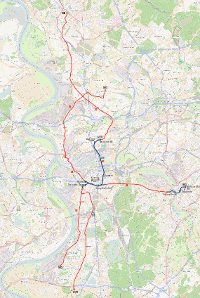
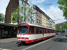
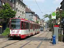
The Duisburg tramway network (German: Straßenbahnnetz Duisburg) is a network of tramways forming part of the public transport system in Duisburg, a city in the federal state of North Rhine-Westphalia, Germany.
Opened in 1881, the network has been operated since 1940 by Duisburger Verkehrsgesellschaft (DVG), and now forms part of the larger Duisburg Stadtbahn system.
Lines
As of 2013, the Duisburg tramway network had the following lines:
| Line |
Route |
Travel time |
Stops |
Headway (rush hour) |
| 901 |
Obermarxloh Schleife – Marxloh Pollmann – Beeck Denkmal – Laar Kirche – Scholtenhofstraße – Ruhrort Friedrichsplatz – Kaßlerfeld – König-Heinrich-Platz – Duisburg Hbf – Zoo/Uni – MH-Speldorf – MH Stadtmitte – Mülheim Hbf |
64 min |
46 |
7.5 / 15 min |
| 903 |
Dinslaken Bf – Walsum Watereck – Marxloh Pollmann – Hamborn Rathaus – Meiderich Süd Bf – Duissern – Duisburg Hbf – König-Heinrich-Platz – Platanenhof – Hochfeld Süd Bf – Wanheim Rheintörchenstraße – Hüttenheim Mannesmann Tor 2 |
69 min |
45 |
7.5 / 15 min |
| Line sections with longer headways in italics |
| Line 902 operates only during events at the Schauinsland-Reisen-Arena; the number 902 is also used to designate trams travelling to and from the Grunewald depot. |
| (902) |
(Walsum Watereck – Marxloh Pollmann – Hamborn Rathaus – Meiderich Süd Bf – Duissern – Duisburg Hbf – König-Heinrich-Platz – Platanenhof – Grunewald Betriebshof) |
|
|
|
See also
References
- Höltge, Dieter (1994). Straßen- und Stadtbahnen in Deutschland [Tramways and Stadtbahnen in Germany]. Band 4: Ruhrgebiet - Von Dortmund bis Duisburg [Volume 4: Ruhr - from Dortmund to Duisburg]. Freiburg i. B., Germany: EK-Verlag. ISBN 9783882553345. (German)
External links
 Media related to Trams in Duisburg at Wikimedia Commons
Coordinates: 51°25′45″N 06°45′18″E / 51.42917°N 6.75500°E / 51.42917; 6.75500
![]() Media related to Trams in Duisburg at Wikimedia Commons
Media related to Trams in Duisburg at Wikimedia Commons