Toposcope
A toposcope or topograph is a marker erected on hills or high places which indicates the direction, and usually the distance, to notable landscape features which can be seen from that point.[1] They are often placed in public parks, country parks, the grounds of stately homes, at popular vantage points (especially accompanying or built into triangulation stations) or places of historical note, such as battlefields.[1]
Toposcopes are often inscribed, and dedicated to particular people or events.[1] They usually show the points of the compass, or at least North.
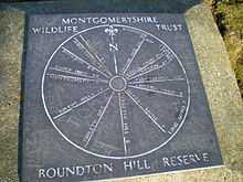
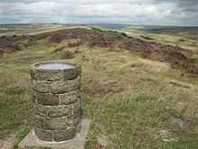
Smaller toposcopes usually consist of a circular plaque, or a plaque with a circle marked on it, mounted horizontally on a plinth.[1] They will have radiating lines indicating the direction to various landmarks, together with the distance and often a pictorial representation of the landmark.[1]
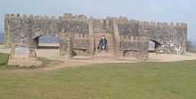
Large toposcopes may be circular paved areas, with numerous plaques around the perimeter, each indicating a particular feature of the landscape.[1]
References
External links
 Media related to Toposcopes at Wikimedia Commons
- Photos of various toposcopes in the UK on geograph.org.uk