Tootool, New South Wales
| Tootool New South Wales | |
|---|---|
|
Tootool rest area | |
|
Tootool | |
| Coordinates | 35°11′14″S 146°58′27″E / 35.18722°S 146.97417°ECoordinates: 35°11′14″S 146°58′27″E / 35.18722°S 146.97417°E |
| Postcode(s) | 2655 |
| Elevation | 188 m (617 ft) |
| Location |
|
| LGA(s) | Lockhart Shire |
| County | Mitchell |
| State electorate(s) | Wagga Wagga |
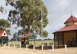
Tootool is a rural community in the central east part of the Riverina. It is situated by road, about 4 kilometres east from French Park and 16 kilometres west from The Rock.
Tootool Post Office opened on 1 August 1901 and closed in 1966.[1]
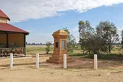
War memorial
Notes and references
- ↑ Premier Postal History, Post Office List, retrieved 2009-06-11
| Preceding station | NSW Branch lines | Following station | ||
|---|---|---|---|---|
French Park towards Oaklands | Oaklands Line | The Rock Terminus |
| Wikimedia Commons has media related to Tootool, New South Wales. |