Tooloom National Park
| Tooloom National Park New South Wales | |
|---|---|
|
IUCN category II (national park) | |
|
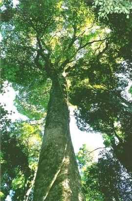
Giant White Beech at Tooloom Scrub | |
 Tooloom National Park | |
| Nearest town or city | Urbenville |
| Coordinates | 28°26′47″S 152°27′13″E / 28.44639°S 152.45361°ECoordinates: 28°26′47″S 152°27′13″E / 28.44639°S 152.45361°E |
| Established | 22 December 1995[1] |
| Area | 43.80 km2 (16.9 sq mi)[1] |
| Managing authorities | NSW National Parks & Wildlife Service |
| Website | Tooloom National Park |
| See also |
Protected areas of New South Wales |
The Tooloom National Park is a protected national park located in the Northern Rivers region of New South Wales, Australia. The 4,380-hectare (10,800-acre) part is situated approximately 616 kilometres (383 mi) north of Sydney and 20 kilometres (12 mi) from the border town of Urbenville.
The park is part of the Focal Peak Group World Heritage Site Gondwana Rainforests of Australia inscribed in 1986[2] and added to the Australian National Heritage List in 2007.[3]
The name Tooloom is derived from Bundjalung word Duluhm meaning headlice,[4] referring to the Tooloom Falls.[5]
Gallery
-

Hollow base of a Strangler Fig, Tooloom Scrub
-

Thorny Yellowwood at Tooloom Scrub
See also
References
- ↑ 1.0 1.1 "Tooloom National Park: Park management". Office of Environment and Heritage. Government of New South Wales. Retrieved 10 September 2014.
- ↑ "Gondwana Rainforests of Australia". Department of the Environment. Australian Government. Retrieved 10 September 2014.
- ↑ "Gondwana Rainforests of Australia, Lismore, NSW, Australia". Australian Heritage Database: Department of the Environment. Australian Government. 2014. Retrieved 10 September 2014.
- ↑ Sharpe, Margaret. "Bundjalung". Macquarie Aboriginal Words. Sydney: Macquarie Library. p. 21.
- ↑ "Tooloom National Park: Park heritage". Office of Environment and Heritage. Government of New South Wales. Retrieved 10 September 2014.
