Tonopah, Arizona
| Tonopah, Arizona | |
|---|---|
| Census-designated place | |
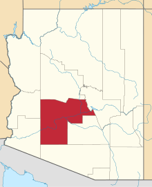
 Location in Maricopa County and the state of Arizona | |
| Coordinates: 33°29′37″N 112°56′14″W / 33.49361°N 112.93722°WCoordinates: 33°29′37″N 112°56′14″W / 33.49361°N 112.93722°W | |
| Country | United States |
| State | Arizona |
| County | Maricopa |
| Established | 1929 |
| Elevation | 1,490 ft (450 m) |
| Population (2000) | |
| • Total | 2,966 |
| Time zone | Arizona Standard Time Zone (Mountain with no Daylight Savings) (UTC-7) |
| ZIP code | 85354 |
| Area code(s) | 623 and 928 |
Tonopah /ˈtoʊnɵpɑː/ is a census-designated place in western Maricopa County, Arizona, United States, approximately 50 miles west of downtown Phoenix off Interstate 10. The community is near the Palo Verde Nuclear Generating Station, the largest power producer in the country, nuclear or otherwise.
Local legend says that the name Tonopah derives from the word Tú Nohwá, meaning "Hot Water Under a Bush". Others say it got its name from the Tonopah/Belmont Mine which was owned by a Tonopah, Nevada, operation. It is located on the Tonopah Desert. Many wells in Tonopah are warm, in the 70 to 95 degrees F range and many are hot; 110 to 120° F wells are common. Prior to being called Tonopah, the settlement was known as Lone Peak.
The area is also known to have been inhabited by groups of people for resource gathering area of the Hohokom, Patayan and Yavapai.
Demographics
As of the census[1] of 2000, there were 2,966 people residing in the CDP. The population density was 43.9 people per square mile. The racial makeup of the CDP was 86.67% White, 1.67% Native American, 3.33% Asian, and 8.33% from other races. 23.33% of the population were Hispanic or Latino of any race.
Schools
- Ruth Fisher Elementary
- Tonopah Valley High School
- Winter's Well Elementary
Incorporation efforts
In 2009, a political action committee named Tonopah United for Our Future (TUFF) filed paperwork with the county, proposing the incorporation of the area into a town.[2] The proposal ran into difficulties when the neighboring town of Buckeye voted to publicly oppose the measure. State law forbids the incorporation of a new city or town within a specified distance of existing municipalities without their approval,[3] and the proposed boundaries for Tonopah would abut the corporate boundaries of Buckeye, essentially giving Buckeye veto power over any incorporation efforts. In 2003, Buckeye had passed a measure approving of any future incorporation effort by Tonopah, but the current town council rescinded the measure, citing concerns that the proposal would extend the new town's boundaries east of the Hassayampa River and into area Buckeye intends to annex.[4] Council members did indicate that they were open to future incorporation efforts using the river as a boundary.
Residents also expressed concern that the proposal was too ambitious and that the new town would be incapable of managing the 100 square miles (260 km2) of land included in the proposal. Geographically it would be among the largest in the state, while estimates placed the population of the proposed town at approximately 6,000. Additionally, a number of residents opposed the plan because they believed large tax increases would be necessary to fund a new government.
Ultimately the measure was defeated on March 10, 2009, by a vote of 523 against incorporation versus 356 in support.[5]
Climate
| Climate data for Tonopah, Arizona (Elevation 1,300ft) | |||||||||||||
|---|---|---|---|---|---|---|---|---|---|---|---|---|---|
| Month | Jan | Feb | Mar | Apr | May | Jun | Jul | Aug | Sep | Oct | Nov | Dec | Year |
| Record high °F (°C) | 82 (28) |
91 (33) |
98 (37) |
105 (41) |
115 (46) |
121 (49) |
119 (48) |
117 (47) |
113 (45) |
104 (40) |
94 (34) |
87 (31) |
121 (49) |
| Average high °F (°C) | 65.7 (18.7) |
70.7 (21.5) |
76.0 (24.4) |
85.5 (29.7) |
94.4 (34.7) |
103.8 (39.9) |
106.8 (41.6) |
104.5 (40.3) |
99.2 (37.3) |
88.3 (31.3) |
75.4 (24.1) |
66.2 (19) |
86.4 (30.2) |
| Average low °F (°C) | 36.8 (2.7) |
40.1 (4.5) |
43.4 (6.3) |
50.5 (10.3) |
59.7 (15.4) |
67.9 (19.9) |
77.0 (25) |
75.6 (24.2) |
67.1 (19.5) |
55.1 (12.8) |
43.2 (6.2) |
36.5 (2.5) |
54.4 (12.4) |
| Record low °F (°C) | 17 (−8) |
22 (−6) |
23 (−5) |
26 (−3) |
41 (5) |
49 (9) |
60 (16) |
54 (12) |
42 (6) |
35 (2) |
16 (−9) |
14 (−10) |
14 (−10) |
| Average precipitation inches (mm) | 1.08 (27.4) |
0.88 (22.4) |
0.75 (19) |
0.27 (6.9) |
0.05 (1.3) |
0.06 (1.5) |
0.62 (15.7) |
1.18 (30) |
0.57 (14.5) |
0.44 (11.2) |
0.61 (15.5) |
1.13 (28.7) |
7.63 (193.8) |
| Average snowfall inches (cm) | 0 (0) |
0 (0) |
0 (0) |
0 (0) |
0 (0) |
0 (0) |
0 (0) |
0 (0) |
0 (0) |
0 (0) |
0 (0) |
0 (0) |
0 (0) |
| Source: The Western Regional Climate Center[6] | |||||||||||||
In popular culture
The chorus of the song "Willin'" by Lowell George of Little Feat on the albums Little Feat, Sailin' Shoes and Waiting for Columbus refers to either Tonopah, Arizona or Tonopah, Nevada:
And I've been from Tucson to Tucumcari, Tehachapi to Tonopah.
I've driven every kind of rig that's ever been made;
driven the backroads so I wouldn't get weighed.
References
- ↑ http://factfinder2.census.gov/faces/tableservices/jsf/pages/productview.xhtml?pid=DEC_10_PL_GCTPL2.ST13&prodType=table
- ↑ Graf, Eric (2009-03-07). "Vote to incorporate Tonopah likely to be challenged". The Arizona Republic. Retrieved 2009-06-12.
- ↑ "§9-101.01". Arizona Revised Statutes. Retrieved 2008-06-21.
- ↑ Graf, Eric (2009-02-06). "Buckeye says 'No' to Tonopah as a town". The Arizona Republic. Retrieved 2009-06-12.
- ↑ "Election Results : March 2009 Election". The Arizona Republic. 2009-03-10. Retrieved 2009-06-12.
- ↑ "Seasonal Temperature and Precipitation Information". Western Regional Climate Center. Retrieved November 18, 2013.
Further reading
- Barnes, Will C., Byrd H. Granger, (ed.), Arizona's Names : X Marks the Place, (Falconer: 1983). ISBN 0-918080-18-5
| |||||||||||||||||||||||||||||||||||||