Tmogvi
| Tmogvi | |
|---|---|
| Aspindza municipality, Samtskhe-Javakheti, Georgia | |
|
The ruins of Tmogvi from the North | |
 Tmogvi | |
| Coordinates | 41°23′43″N 43°19′00″E / 41.3954°N 43.3167°E |
| Site information | |
| Condition | Ruined |
| Site history | |
| Built | 10th century |
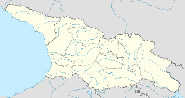
Tmogvi (Georgian: თმოგვი; Armenian: Թմկաբերդ Tmkaberd) is a ruined fortress in the southern Georgian region of Samtskhe-Javakheti, on the left bank of the Kura River, a few kilometers downstream of the cave city of Vardzia.
History
The name "Tmogvi" is derived from Armenian word mog (մոգ) meaning 'pagan priest' or 'magus'.[1] The fortress is first mentioned in sources from the 9th century.[1] It was built as a defensive work controlling the ancient trade route between the Armenian plateau and the lowlands of Iberia (or Kartli, present-day Eastern Georgia), over a gorge formed by the Kura River. It was a crucial military stronghold in the region of Javakheti (Javakhk in Armenian), one of the borderlands between Armenia and Georgia. The feudal lords of the region were at that time the Bagratids, either of the Armenian or the Georgian branch.[2]
Tmogvi gained importance after the neighboring town and fortress of Tsunda was ruined around 900 AD. By the beginning of the 11th century, the fortress had passed under the direct control of the unified Kingdom of Georgia.
In 1073, it was given in apanage to the nobleman Niania Kuabulisdze; his descendants kept it in the following centuries, before it passed to other major feudal families such as the Toreli, the Mkhargrzeli, the Shalikashvili or the Jaqeli. In 1088, the castle collapsed in an earthquake. The medieval Georgian writer Sargis Tmogveli was from Tmogvi. The Ottoman Empire gained control of the fortress in 1578. In 1829, the Treaty of Adrianople transferred the fortress, among with the surrounding region, to the Russian Empire.
Architecture
The castle of Tmogvi was built on top of a mountain high above the Kura river. It expands over 3 hills, joined and encircled by a wall (150 meters long, 3 meters wide), which supplements the natural defense offered by the cliffs. A number of towers was built on each hill. A secret tunnel connects the castle with the river to provide access to water even during a siege. The western part of the fortress is better preserved. A small number of buildings subsist inside the castle itself. A quadrangular building made of tuff on a basalt foundation is assumed to have been a church. Outside of the walls, on the western side, the church of Saint Ephrem subsists in ruined condition, with fragments of frescoes from the 13th century.
In literature
In 1902, Armenia's national poet Hovhannes Tumanyan wrote one of his most famous poems, titled The Capture of Tmkaberd (Թմկաբերդի առումը).[3][4]
References
Notes
- ↑ 1.0 1.1 Karapetian 2011, p. 192.
- ↑ Toumanoff, Cyril, "The Armeno-Georgian Marchlands", in Studies in Christian Caucasian History, Georgetown, 1963, pp. 485-496. Accessible online at
- ↑ "Tumanian, Ovanes Tadevosovich". Great Soviet Encyclopedia. Retrieved 26 November 2013.
- ↑ Holding, Nicholas (2008). Armenia: with Nagorno Karabagh : the Bradt travel guide (2nd ed.). Chalfont St. Peter: Bradt Travel Guides. pp. 98–99. ISBN 9781841621630.
Sources
- Berdzenishvili D., Sagharadze Sh., Georgian Soviet Encyclopedia, volume 4, p. 688, Tbilisi, 1979 (in Georgian)
- Karapetian, Samvel (2011). Javakhk (PDF). Yerevan: Research on Armenian Architecture. pp. 192–204. ISBN 978-99941-875-7-7.
