Tittybong, Victoria
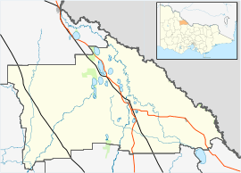
Tittybong is a locality in the northwest of Victoria, Australia, within the Shires of Gannawarra and Buloke. Tittybong is located west of Kerang and east of the Calder Highway. It is south of Swan Hill, Tittybong's nearest large town.
History
The Tittybong Post Office opened on 1 January 1884 and closed in 1968.[1]
References
|
|---|
|
- Appin
- Appin South
- Bael Bael
- Beauchamp
- Benjeroop
- Budgerum East
- Burkes Bridge
- Cannie
- Capels Crossing
- Cohuna
- Cullen
- Daltons Bridge
- Dingwall
- Fairley
- Gannawarra
- Gonn Crossing
- Gredgwin
- Horfield
- Keely
- Kerang
- Kerang East
- Koondrook
- Koroop
- Lake Charm
- Lake Meran
- Lalbert
- Leitchville
- Macorna
- Macorna North
- McMillans
- Mead
- Meatian
- Meering West
- Milnes Bridge
- Mincha West
- Murrabit
- Murrabit West
- Myall
- Mystic Park
- Ninyeunook
- Normanville
- Oakvale
- Pine View
- Quambatook
- Reedy Lake
- Sandhill Lake
- Teal Point
- Tittybong
- Towaninny
- Tragowel
- Wandella
- Wee Wee Rup
- Westby
|
|