Tinsel Dome
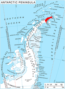
Location of Trinity Peninsula.
Tinsel Dome (63°44′S 58°55′W / 63.733°S 58.917°WCoordinates: 63°44′S 58°55′W / 63.733°S 58.917°W) is a small ice-covered hill, 700 m, standing between Aureole Hills and Bone Bay on Trinity Peninsula. Charted in 1948 by the Falkland Islands Dependencies Survey (FIDS) who gave this descriptive name.
Map
- Trinity Peninsula. Scale 1:250000 topographic map No. 5697. Institut für Angewandte Geodäsie and British Antarctic Survey, 1996.
References
![]() This article incorporates public domain material from the United States Geological Survey document "Tinsel Dome" (content from the Geographic Names Information System).
This article incorporates public domain material from the United States Geological Survey document "Tinsel Dome" (content from the Geographic Names Information System).