Ti'inik
| Ti'inik | |
|---|---|
| Other transcription(s) | |
| • Arabic | تعّنك |
 Ti'inik Location of Ti'inik within Palestine | |
| Coordinates: 32°31′11.01″N 35°13′15.81″E / 32.5197250°N 35.2210583°ECoordinates: 32°31′11.01″N 35°13′15.81″E / 32.5197250°N 35.2210583°E | |
| Palestine grid | 170/214 |
| Governorate | Jenin |
| Government | |
| • Type | Village council |
| Population (2006) | |
| • Jurisdiction | 1,095 |
Ti'inik (Arabic: تعّنك; Hebrew: טיעיניק), also transliterated Ta'anakh, Ti’innik or Taanach, is a Palestinian village in the West Bank, located 13 km Northwest of the city of Jenin in the northern West Bank. The neighbouring Israeli region of Ta'anakh is named after the town.
According to the Palestinian Central Bureau of Statistics, the town had a population of 1,095 inhabitants in mid-year 2006.[1]
Archaeology

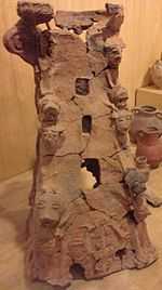
Just to the east is a 40-metre-high mound which was the site of the biblical city Taanach. Twelve Akkadian cuneiform tablets were found here. Approximately one third of the names on these tablets are of Hurrian origin, indicating a significant northern ethnic presence.[2][3] The main remains visible today are of an 11th-century Abbasid palace.[4]
Bibliography
- Barron, J. B., ed. (1923). Palestine: Report and General Abstracts of the Census of 1922. Government of Palestine.
- Conder, Claude Reignier; Kitchener, H. H. (1882). The Survey of Western Palestine: Memoirs of the Topography, Orography, Hydrography, and Archaeology 2. London: Committee of the Palestine Exploration Fund. (p. 46, 68)
- Dauphin, Claudine (1998). La Palestine byzantine, Peuplement et Populations. BAR International Series 726 (in French). III : Catalogue. Oxford: Archeopress. (p. 743)
- Guérin, Victor (1875). Description Géographique Historique et Archéologique de la Palestine (in French). 2: Samarie, pt. 2. Paris: L'Imprimerie Nationale. (pp. 226 -228)
- Hadawi, Sami (1970). Village Statistics of 1945: A Classification of Land and Area ownership in Palestine. Palestine Liberation Organization Research Center.
- Hütteroth, Wolf-Dieter; Abdulfattah, Kamal (1977). Historical Geography of Palestine, Transjordan and Southern Syria in the Late 16th Century. Erlanger Geographische Arbeiten, Sonderband 5. Erlangen, Germany: Vorstand der Fränkischen Geographischen Gesellschaft. ISBN 3-920405-41-2. (p. 159)
- Mills, E., ed. (1932). Census of Palestine 1931. Population of Villages, Towns and Administrative Areas. Jerusalem: Government of Palestine.
- Palmer, E. H. (1881). The Survey of Western Palestine: Arabic and English Name Lists Collected During the Survey by Lieutenants Conder and Kitchener, R. E. Transliterated and Explained by E.H. Palmer. Committee of the Palestine Exploration Fund. (p. 153)
Footnotes
- ↑ Projected Mid -Year Population for Jenin Governorate by Locality 2004- 2006 Palestinian Central Bureau of Statistics
- ↑ Gustavs, A. (1927) Die Personennamen in den Tontafeln von Tell Ta-annek. ZDPV 50, 1-18.
- ↑ Glock, A.E. (1971) A New Ta-annek Tablet. BASOR 204, 17-30.
- ↑ Dave Winter Israel handbook: with the Palestinian Authority areas p644
External links
- The Archaeology of Ottoman Ti’innik
- Welcome To Ti'innik
- Survey of Western Palestine, Map 8: IAA, Wikimedia commons
| ||||||||||||||||
