Thung Chang District
| Thung Chang ทุ่งช้าง | |
|---|---|
| Amphoe | |
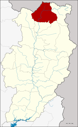 Amphoe location in Nan Province | |
| Coordinates: 19°23′14″N 100°52′33″E / 19.38722°N 100.87583°ECoordinates: 19°23′14″N 100°52′33″E / 19.38722°N 100.87583°E | |
| Country |
|
| Province | Nan |
| Government | |
| • District officer | Kiansak Pomthongkham |
| Area | |
| • Total | 760.811 km2 (293.751 sq mi) |
| Population (2013) | |
| • Total | 18,375 |
| • Density | 24/km2 (63/sq mi) |
| Time zone | THA (UTC+7) |
| Postal code | 55130 |
| Geocode | 5508 |
Thung Chang (Thai: ทุ่งช้าง) is a district (Amphoe) in the northern part of Nan Province, northern Thailand.
History
Thung Chang district dates back to the Kwaeng Khun Nan (ขุนน่าน), which was converted into the district Lae (และ) in 1914. In 1961 it was renamed to Thung Chang, as the district office had been moved to tambon Thung Chang.[1][2]
Geography
Neighboring are from the east clockwise Chaloem Phra Kiat, Pua, Chiang Klang and Song Khwae of Nan Province. To the north is Xaignabouli of Laos. The eastern part of the district is located in the Luang Prabang Range mountain area of the Thai highlands.[3]
Administration
Central administration
The district Thung Chang is subdivided into 4 subdistricts (Tambon), which are further subdivided into 40 administrative villages (Muban).
| No. | Name | Thai | Villages | Pop.[4] |
|---|---|---|---|---|
| 1. | Pon | ปอน | 8 | 2,761 |
| 2. | Ngop | งอบ | 11 | 5,551 |
| 3. | Lae | และ | 14 | 4,642 |
| 4. | Thung Chang | ทุ่งช้าง | 7 | 5,421 |
Local administration
There are 2 subdistrict municipalities (Thesaban Tambon) in the district:
- Ngop (Thai: เทศบาลตำบลงอบ) consisting of the complete subdistrict Ngop.
- Thung Chang (Thai: เทศบาลตำบลทุ่งช้าง) consisting of parts of the subdistricts Lae and Thung Chang.
There are 3 subdistrict administrative organizations (SAO) in the district:
- Pon (Thai: องค์การบริหารส่วนตำบลปอน) consisting of the complete subdistrict Pon.
- Lae (Thai: องค์การบริหารส่วนตำบลและ) consisting of parts of the subdistrict Lae.
- Thung Chang (Thai: องค์การบริหารส่วนตำบลทุ่งช้าง) consisting of parts of the subdistrict Thung Chang.
References
- ↑ nakornnan.com
- ↑ พระราชกฤษฎีกาเปลี่ยนชื่ออำเภอและตำบลบางแห่ง พ.ศ. ๒๕๐๔. Royal Gazette (in Thai) 78 (33 ก): 382–. April 11, 1961.
- ↑ ดร.กระมล ทองธรรมชาติ และคณะ, สังคมศึกษา ศาสนาและวัฒนธรรม ม.1, สำนักพิมพ์ อักษรเจริญทัศน์ อจท. จำกัด, 2548, หน้า 24-25
- ↑ "Population statistics 2013" (in Thai). Department of Provincial Administration. Retrieved 2014-12-03.
External links
| Wikimedia Commons has media related to Thung Chang District. |
- amphoe.com (Thai)
- http://www.thungchang.com (Thai)