Thousandsticks, Kentucky
| Thousandsticks, Kentucky | |
|---|---|
| Unincorporated community | |
 Thousandsticks, Kentucky | |
| Coordinates: 37°11′06″N 83°25′44″W / 37.18500°N 83.42889°WCoordinates: 37°11′06″N 83°25′44″W / 37.18500°N 83.42889°W | |
| Country | United States |
| State | Kentucky |
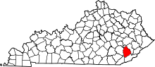
| County | Leslie |
| Elevation | 961 ft (293 m) |
| Time zone | Eastern (EST) (UTC-5) |
| • Summer (DST) | EDT (UTC-4) |
| ZIP code | 41766 |
| Area code(s) | 606 |
| GNIS feature ID | 515934[1] |
Thousandsticks is an unincorporated community in Leslie County, Kentucky, United States. Thousandsticks is located at the junction of the Hal Rogers Parkway and Kentucky Route 118 3.5 miles (5.6 km) northwest of Hyden. Thousandsticks had a post office with ZIP code 41766 [2] which closed in 2005.[3]
History
A post office called Thousandsticks has been in operation since 1924.[4] The community was named after nearby Thousandsticks Branch.[5]
References
- ↑ U.S. Geological Survey Geographic Names Information System: Thousandsticks, Kentucky
- ↑ ZIP Code Lookup
- ↑ http://about.usps.com/who-we-are/postmasterfinder/welcome.htm
- ↑ "Leslie County". Jim Forte Postal History. Retrieved 29 April 2015.
- ↑ Bergstrom, Bill (December 11, 1984). "Origins of place names are traced". Kentucky New Era. pp. 2B. Retrieved 29 April 2015.
| |||||||||||||||||