Thorndon, New Zealand
- See also Thorndon Hall
| Thorndon | |
|---|---|
 Thorndon | |
| Basic information | |
| Local authority | Wellington City |
| Population | 3,840 (2006 [1]) |
| Facilities | |
| Train station(s) | Wellington Railway Station |
| Ferry terminal(s) | Wellington Interislander Terminal, Wellington Bluebridge Terminal |
| Surrounds | |
| North | Wadestown |
| East | Wellington Harbour |
| South | Wellington CBD, Kelburn |
| Southwest | Northland |
| Northwest | Wilton |

and the old wooden administration building

circa 1877 on the site of the Beehive
Old Parliament Buildings at the left
on the site of the Parliamentary Library
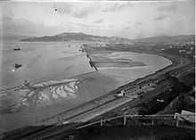
Thorndon Quay and Mulgrave Street
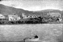
Pipitea Pā with St Paul's pro-cathedral
Thorndon is a historic inner suburb of Wellington, the capital city of New Zealand. Comparatively level Thorndon contained hilly Wellington's elite residential area until long after motorised transport became usual but the best of its heart was almost entirely destroyed in the 1960s by a new motorway and the erection of tall office buildings on the sites of its Molesworth Street retail and service businesses.
Thorndon combines upmarket residential accommodation and the home of government, and is located at the northern end of the Central Business District.
Features of Thorndon
The suburb is dominated by transportation links, government offices, and schools, and is also the location of one of the country's main sports venues, the Westpac Stadium.
Many embassies, high commissions and consulates are located in Thorndon including: the US, Chinese, Cuban, German, Italian, Philippine, Thai and Turkish Embassies; the Australian, British, Canadian, Cook Islands, Fijian, Indian, and Niue High Commissions; and the Norwegian and Swedish Consulates-General.
Thorndon events
The Thorndon Fair is held annually, usually on the first Sunday of December. The fair has many stalls selling crafts and second-hand goods and is held for the benefit of Thorndon School. It has taken place for many years and is one of the main community events held in Thorndon. Parts of Tinakori Road and Hill Street are closed during the fair.
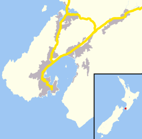
Geographic boundaries
Pipitea Point, Thorndon Quay and the Hobson Street houses above it
Thorndon occupies the northern end of the narrow coastal plain that makes up the heart of Wellington. It is flanked by the green hills of Wadestown to the west and the port facilities of Wellington Harbour to the east.
The boundaries of Thorndon form an approximate triangle. Starting from the lower south-west corner, at the intersection of Glenmore St and Collins Tce, the boundary goes up through Tinakori Hill, across through Weld St and along to Baker St. Then the boundary follows the west side of Thorndon Quay down until Hill St, where it goes across to Bowen St, Tinakori Road and Glenmore St (until Collins Tce).
Naming
One of the few comparatively flat areas on the harbour, Thorndon became a significant part of Port Nicholson's first organised European settlement in 1840. European settlers built their houses alongside the Maori settlement of Pipitea and named their portion after Thorndon, the family residence of W H F Petre, a director of their organisation, The New Zealand Company.[2]
Sir Robin Cooke, who grew up beside the Thorndon tennis club, took the title of Lord Cooke of Thorndon when raised to the peerage - although prior to his death on 30 August 2006 he lived in Karori.
Notable residents
Ex officio
- Governor General Bowen Street from 1871 to 1907 [note 1] on what is now the site of the Beehive
- Prime Minister at 260 Tinakori Road
- Cabinet ministers
- Anglican Bishop of Wellington
- Catholic Archbishop of Wellington and Metropolitan of New Zealand
Private citizens

Hobson Street
- Charles Abraham (bishop of Wellington)
- Alfred Brandon (politician)
- Alfred Brandon (mayor)
- Alfred Brandon (lawyer)
- William Henry Clayton
- Sir Charles Clifford, 1st Baronet
- John Duncan (merchant 1839-1919) now the site of the Australian High Commission
- Robert Hart (politician)
- Charles Beard Izard

T C Williams's tower in the background
- Jacob Joseph (merchant)
- Sir Arthur Myers, Cabinet Minister[3]
- Joseph Nathan merchant
- Joseph Edward Nathan merchant, founded Glaxo now GlaxoSmithKline
- Evelyn Margaret Page
- Robert Pharazyn merchant and runholder
- William Pharazyn merchant and runholder
- Robert Stains
- Thomas Coldham Williams (1825-1912) runholder now Queen Margaret College
Tinakori Road

- Rita Angus Sydney Street
- Harold Beauchamp banker
- Elsdon Best
- George Hunter (mayor)
- Walter Woods Johnston
- Nathaniel Levin merchant
- William Levin merchant and runholder now Pendennis, 15 Burnell Avenue
- Douglas Lilburn Ascot Street
- Katherine Mansfield [note 2]
- Andrew Todd (New Zealand)
T C Williams's house is said to have had more than 30 rooms
Fitzherbert Terrace
- John Johnston (New Zealand politician) merchant and runholder now Katherine Avenue and tennis club courts
Hill Street
Bowen Street
- Alexander Horsburgh Turnbull
Murphy Street
References
- ↑ when Government House was taken over by Parliament following the destruction of Parliament Buildings by fire, (that building was eventually demolished to erect the Beehive) and a new residence built by the Basin Reserve
- ↑ both her birthplace and her family's residence after 1898 at 75 Tinakori Road — destroyed for the motorway.
- ↑ Quickstats about Thorndon-Tinakori Road
- ↑ E J Wakefield, Adventure in New Zealand, Vol.I, p. 100
- ↑ Paul Goldsmith and Michael Bassett, The Myers, David Ling Publishing Ltd, Auckland, 2007.
External links
| Wikimedia Commons has media related to Thorndon. |
| ||||||||||||||||||||||
Coordinates: 41°16′30″S 174°46′40″E / 41.2750°S 174.7779°E