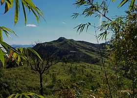
Thingdawl Te Tlang
| Thingdawlte Tlang | |
|---|---|
 Thingdawlte Tlang | |
| Elevation | 959.8 m (3,149 ft) |
| Listing | List of mountains of Bangladesh |
| Location | |
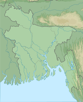 Thingdawlte Tlang Geo position of Thingdawlte Tlang | |
| Location | Ruma Bandarban |
| Range | Lowmbok Row |
| Coordinates | 21°54′37″N 92°35′22″E / 21.91028°N 92.58944°ECoordinates: 21°54′37″N 92°35′22″E / 21.91028°N 92.58944°E |
| Geology | |
| Type | Mountain |
Thingdawlte Tlang[1] is a significant peak of Bangladesh.This peak is the Highest point of 'lawmbok Row' range and possible 7th highest of the country.In December,2012 a local explorer Fahim Hasan of "BD Explorer"[2] summited the peak of Thingdawlte Tlang and measured the height for the first time.Which is 3149 feet(959.8 m).[3] Gps accuracy was 3m(+/-).The name of the peak was collected by BD Explorer and confirmed by the local tribal people of Thingdawl Te village. Few days later Zaqiul Deep of "Travelers Of Bangladesh" measured the peak as 3,133 feet(955m). The most easiest route to summit this peak is to start from Ruma of Bandarban district.[4] Nearest sattlement is known as Thingdawlte(Bawm)village.This peak is named after this village.
See also
- Geography of Bangladesh
- List of countries by highest point
- List of mountains of Bangladesh