The Californias
.JPG)
The Californias, or "Province of the Californias" (1768-1804, Spanish: Provincia de las Californias), was the northwestern-most area of New Spain (the viceroyalty comprised Spain's colonial possessions in the Western Hemisphere, plus the Philippines and other Pacific islands). The province included the Baja California peninsula, the new settlements established to the north during this period (in the present-day U.S. state of California), and coastal claims made earlier to the north and east that lacked a colonist presence.
The single province of the Californias was split, in 1804, into Alta (upper) and Baja (lower). The eastern border of Alta California was never officially defined either under Spanish or later Mexican rule,[1] but the northern border was fixed at 42 degrees latitude by the Adams-Onis Treaty of 1819.
Following Mexico's defeat in the Mexican-American War, Alta California territory was ceded on 2 February 1848 to the United States, and the terms Las Californias and Alta California were no longer formally used. The areas in North America acquired by the U.S. were regarded as "territories", with the modern state of California acquiring statehood two years later.
Geography
The Baja California peninsula is bordered on three sides by water, while Alta California has the water of the Pacific Ocean only on the west. Inland regions were mostly unexplored by the Spanish, leaving them generally outside the control of the colonial authorities. The Sierra Nevada and San Gabriel mountain ranges, backed by the inhospitable Mojave Desert, served as natural barriers to Spanish settlement. The 1781 Instrucciones and government correspondence described Alta California ("Upper California") as the areas to the west of the Sierra Nevada and the part of the Colorado River that now forms the southeastern border of the state of California.[2] To the east of the Californias was the gobernación (province) of Sonora y Sinaloa, which included the Spanish settlements in Arizona. Further east was the province of Nuevo México, and although the exact border between the two was not fixed, the territory defined as Alta California during negotiations preceding the 1848 Treaty of Guadalupe Hidalgo included today's Nevada, Utah and parts of Arizona, Colorado and Wyoming.
Political organization
Much of the early Spanish presence in the region of Baja California was by the Jesuits. The missionaries were sent out in the 17th century to convert and to politically and socially reorganize the indigenous peoples. The network of missions established by the Jesuits were protected by small detachments of soldiers stationed at each mission, and a larger force in the presidio at Loreto. Once the missions and the Native communities organized around them were successfully established, secular settlements of Hispanic peoples from other parts of northern New Spain were created. This process was first carried out during the 17th and 18th centuries in Baja California, and was repeated in the late 18th century in the area that is today the State of California.
Explorer Gaspar de Portolà was the first governor of Las Californias and established the first Alta California settlements in 1769-70 at today's cities of San Diego and Monterey. Portolà was succeeded as governor in Monterey by Pedro Fages in 1770.
The Californias fell under the jurisdiction of the Audiencia of Guadalajara in judicial matters. In 1776 the Californias became part of the Commandancy General of the Provincias Internas. In 1786, an independent intendancy was set up to administer government and military finances of Baja California, but the office was merged with the governorship a few years later.
First explorations and early history
The Spanish explored the coastal area of the Californias by sea beginning in the 16th century and claimed the coastal areas for Spain. The first recorded Europeans to sight the Californias sailed in La Concepción in 1533 under the pilot navigator Fortún Jiménez in an expedition organized by conquistador and New Spain administrator Hernán Cortés. Jiménez reached La Paz, where establishment of a small colony was attempted. In 1535, Cortés himself participated in a second expedition, which explored the Sea of Cortez (Gulf of California).[3] At the time of Cortés's expeditions, the region was occupied by a wide variety of Indigenous peoples. Juan Rodríguez Cabrillo's 1542 expedition, commissioned by Viceroy Antonio de Mendoza, was the next to reach the area sailing via the Pacific Ocean following the coast of the Baja California peninsula to a point beyond 40° North latitude. He named the discovered territory Nueva California (New California), as opposed to Vieja California (Old California), which were the coasts of which had already been sailed and explored.
After the early maritime explorations, various plans to settle the Californias were developed but none succeeded until the 1769 Portolá expedition. Among the failed plans were:
- Sebastián Vizcaíno's expedition in 1602–03 preparatory to colonization planned for 1606–07 which was cancelled in 1608;
- plans promoted by Father Eusebio Kino who missionized the Pimería Alta from 1687 until his death in 1711,
- plans by Juan Manuel de Oliván Rebolledo in 1715 resulting in a decree in 1716 for extension of the conquest (of Baja California) which came to nothing;
- Juan Bautista de Anza I proposing an expedition from Sonora in 1737;
- a plan by the Council of the Indies in 1744; and
- Don Fernando Sánchez Salvador, having researched the earlier proposals, suggested the area of the Gila and Colorado Rivers as the locale for forts or presidios preventing the French or the English from "occupying Monterey and invading the neighboring coasts of California which are at the mouth of the Carmel River."[4][5]
Colonization
For almost a century, the mission effort of the Jesuits, was confined to Baja California. The first mission in Baja California, the short-lived Misión San Bruno, was established in 1683, but the first successful mission was established in 1697 with the Misión de Nuestra Señora de Loreto Conchó in Loreto. The first secular Hispanic settlement in the Californias was Loreto, which became the first capital of the territory.
The second half of the 18th century brought about changes in policy for several reasons. Foreign powers, in particular Russian, and to a lesser extent British, seemed interested in the region for the purpose of fur trading. Spain was aware of Russian colonization and maritime fur trading in Alaska. The 1768 naval expedition of Pyotr Krenitsyn and Mikhail Levashev, in particular, alarmed the Spanish government.[6] To ascertain the Russian threat, a number of Spanish expeditions to the Pacific Northwest were launched.
At the same time, the administration of the area was revitalized by the Bourbon political reforms carried out under José de Gálvez, who was first a visitador (inspector) to the Viceroyalty of New Spain and later the Minister of the Indies. Gálvez, an idealist, hoped to revitalize the Spanish Empire by reorganizing marginal areas into captaincies-general and intendancies, improving their governance, growing their economy and settling uncolonized areas.
In preparation for creation of Alta California, that country would be granted to Jesuits, as it had been in Baja California, to convert the Native population to Catholicism, following a model that had been used for over a century in Baja California. The Spanish Crown funded the construction and subsidized the operation of the missions, with the goal that the relocation, conversion and enforced labor of Native people would bolster Spanish rule. This plan was changed when the crown ordered the expulsion of the Jesuits from all Spanish territories in 1767. The Franciscans were selected to take over the missions in Baja California, under the direction of Junipero Serra who accompanied the Portolá expedition in 1769. After Serra's death in 1773, Francisco Palóu assumed direction of the Alta California missions. The Dominicans replaced the Jesuits in Baja California.
Following the land exploration of Alta California, first by Portolá in 1769-70, and founding of the first missions and presidios, colonists were recruited and sent north to help build the necessary structures, and to establish civilian pueblos at San Jose (1777) and Los Angeles (1781). The Villa de Branciforte, founded in 1797, failed and although became a small settlement, was never granted municipal status. Other settlers, singly and in groups, came periodically from Mexico, but never enough to create a large Spanish-speaking population.
Border
The Baja California peninsula was referred to at times as Vieja California (Old California), while the region to the north was called Nueva California (New California), later Alta California (Upper California). The exact border between the missionary orders' territories in the Californias was established in 1773 by Francisco Palóu, on a line that reached the Pacific coast in the area of Playas de Rosarito, about 20 mi (25 km) south of the current United States-Mexico border. The first border was at Punta El Descanso, today occupied by the Centro Histórico y Cultural Calafia. It was later moved in 1778 to the Rosarito Creek.
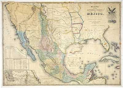
Alta California
.JPG)
With the suppression of the Society of Jesus, the Jesuits' existing Baja California missions were given briefly to the Franciscans. When the Portolà expedition was initiated, the Baja missions were turned over to the Dominicans to operate, while the proposed missions in Alta California were developed by the Franciscans, led by Junipero Serra. The first Alta California mission was Mission San Diego de Alcalá, in 1769.
The Portolà expedition was composed of both military and missionary personnel. The first military bases (presidios) were established concurrently with the first missions: the Presidio of San Diego along with Mission San Diego, and the Presidio of Monterey along with Mission San Carlos Borromeo. Later presidios at San Francisco and Santa Barbara extended military coverage to the entire string of 21 missions.
As mandated by the Laws of the Indies, Gálvez's plans also included secular municipalities called pueblos or, in one case, a villa. Each pueblo had a Cabildo (council) The pueblos were established settlers recruited from more established provinces of New Spain (mainly from Mexico), and by retiring soldiers who were encouraged to stay in California. These were supplemented by smaller numbers of convicts (again mainly from Mexico), sometimes given a choice of prison or California. The first pueblo in Alta California was the Pueblo de San José de Guadalupe in 1777, followed by the Pueblo de Los Angeles in 1781. The Villa de Branciforte was the last, established in 1797. Other settlements formed around the presidios in Monterey and Santa Barbara. Spanish land grant Ranchos were the third part of establishing a proactive presence in northwestern New Spain. These large grants usually went to retired presidio military officers, political leaders and top-level administrators.
As Alta California developed and gained a larger Hispanic population, the need for a separate government became apparent. In 1804 the two areas were separated and Baja California peninsula and Alta California given separate governors.[8] Some sources credit Diego de Borica with defining Alta and Baja California's official borders.[9] José Joaquín de Arrillaga was the last governor of both areas (1800-1804) and the first governor of Alta California alone (1804-1814).
The name Las Californias was revived in 1836, when the Siete Leyes constitutional reforms in Mexico recombined the two Californias into a single French-style Departamento de Las Californias. The 1836 constitution was repealed in 1847, during the Mexican-American War, but the war prevented a re-establishment of territorial governments before the Treaty of Guadalupe Hidalgo ceded Mexican lands north of Baja California to the United States.
Statehood
The new areas acquired by the United States in 1848 continued to be administered as territories, with today's California springing into statehood a mere two years later. But by the early 20th century all of the remaining territories - New Mexico, Arizona, Nevada, Utah, and parts of Wyoming and Colorado - had become states.
Mexico reorganized the Territory of Baja California into two territories in 1931: North Territory of Baja California and South Territory of Baja California. By the end of the 20th century, each had become a state, Baja California in 1952 and Baja California Sur in 1974.
Timeline
- 1533- First European landing in "California", on the lower Baja California peninsula by Fortún Jiménez.
- 28 September 1542- First European landing near upper California by Juan Rodríguez Cabrillo in Ensenada (in Baja California).
- 4 November 1595- Sebastián Rodríguez Cermeño claims the Pacific coast for Spain.
- Approximately 100 years of inactivity and no presence in Baja California, and 200 years of inactivity or presence in Alta California.
- 1697 - Jesuit Missions erected in southern Baja California.
- 1768 - Governorship established for Las Californias Province.
- 1769 - Spanish settlement begins in Alta California.
- 1786 - Intendancy of Las Californias Province established.
- 1804 - Separate administrations for Alta California and Baja California Provinces.
- 11 April 1822- Both provinces become part of the new independent nation of Mexico
- 1824 - Former Spanish provinces reorganized as the territories of Baja California and Alta California.
- 2 February 1848 - Alta California territory ceded to the United States, the terms Las Californias and Alta California therefore lost official use.
Spanish Governors
- 1768 - 9 July 1770 Gaspar de Portolá (1723–1786)
- 9 July 1770 - 23 March 1774 Pedro Fages (1730 - 1796?)
- 23 March 1774 - 3 February 1777 Fernando José Rivera y Moncada (1724–1781)
- 3 February 1777 - 7 September 1782 Felipe de Neve (1728–1784)
- 7 September 1782 - 17 April 1791 Pedro Fages (s.a.)
- 17 April 1791 - 9 April 1792 José Antonio de Roméu, conde de Riverra Gigado (1842 - 1792)
- 9 April 1792 - November 1794 José Joaquín de Arrillaga (First time) (1750–1814) (acting)
- November 1794 - 16 January 1800 Diego de Borica (1742–1800)
- 16 January 1800 - 11 March 1802 Pedro de Alberni (acting) (1747–1802)
- 11 March 1802 - 1804 José Joaquín de Arrillaga (Second time) (s.a.)
See also
- List of governors in the Viceroyalty of New Spain
- Spanish missions in Baja California
- Spanish missions in California
- Indigenous peoples of Baja California
- Indigenous peoples of California
- Population of Native California
- Ranchos of California
- History of California
- History of California through 1899
- Spanish colonization of the Americas
Notes
- ↑ José Bandini, in a note to Governor Echeandía or to his son Juan Bandini, a member of the Territorial Deputation (legislature), noted that Alta California was bounded "on the east, where the Government has not yet established the [exact] border line, by either the Colorado River or the great Sierra (Sierra Nevadas)." A Description of California in 1828 by José Bandini (Berkeley, Friends of the Bancroft Library, 1951), 3. Reprinted in Mexican California (New York, Arno Press, 1976). ISBN 0-405-09538-4
- ↑ Chapman, Charles Edward (1973) [1916]. The Founding of Spanish California: The Northwestward Expansion of New Spain, 1687-1783. New York: Octagon Books. pp. xiii.
- ↑ Mathes, W. Michael. "An Historical Survey of the Missions". (La Paz: Aristos, 1977). Retrieved on 2008-08-09.
- ↑ Plans for the Occupation of Upper California: A New Look at the "Dark Age" from 1602 to 1769, The Journal of San Diego History, San Diego Historical Society Quarterly, Winter 1978, Volume 24, Number 1
- ↑ The elusive West and the contest for empire, 1713–1763, Paul W. Mapp, Omohundro Institute of Early American History & Culture
- ↑ Haycox, Stephen W. (2002). Alaska: An American Colony. University of Washington Press. pp. 59–60. ISBN 978-0-295-98249-6.
- ↑ Antonio García Cubas. Atlas geográfico, estadístico e histórico de la República Mexicana. J. M. Fernández de Lara, 1857.
- ↑ Altable, Francisco (2002). "Los años de la gobernación de California: Los gobiernos de Arrillaga, Goicoechea y Argüello". In González Cruz, Edith; Altable, María Eugenia. Historia general de Baja California Sur: Los Procesos Políticos 2. La Paz: Seminario de Investigación en Historia Regional, Universidad Autónoma de Baja California Sur. p. 181. ISBN 970-722-199-2.
- ↑ "California Under Spanish Rule". www.books-about-california.com. Retrieved 2010-04-28.
References
- Bancroft, Hubert Howe (1884). History of California: 1542-1800. The Works of Hubert Howe Bancroft 18. San Francisco: A. L. Bancroft & Company.
- Bancroft, Hubert Howe (1886). History of California: 1801-1824. The Works of Hubert Howe Bancroft 19. San Francisco: A. L. Bancroft & Company.
- Beebe, Rose Marie (2001). Lands of Promise and Despair: Chronicles of Early California, 1535-1846. Berkeley: Heyday Books. ISBN 1-890771-48-1.
- Bouvier, Virginia Marie (2001). Women and the Conquest of California, 1542–1840: Codes of Silence. Tucson: University of Arizona. ISBN 978-0-8165-2446-4.
- Chapman, Charles E. (1916). The Founding of Spanish California: The Northwestward Expansion of New Spain, 1687-1783. New York: Macmilan.
- Chapman, Charles E. (1921). A History of California: The Spanish Period. New York: Macmillan.
- Forbes, Alexander (1919) [1839]. California: A History of Upper and Lower California from Their First Discovery to the Present Time. San Francisco: Thomas C. Russell.
- González Cruz, Edith; Altable, María Eugenia, eds. (2003). Historia general de Baja California Sur: Los procesos políticos 2. Mexico City: Plaza y Valdes. ISBN 970-722-199-2.
| ||||||||||||||||||||||||||||||||