Thawat Buri District
| Thawat Buri ธวัชบุรี | |
|---|---|
| Amphoe | |
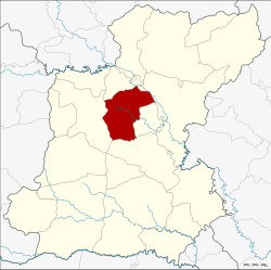 Amphoe location in Roi Et Province | |
| Coordinates: 16°02′19″N 103°44′49″E / 16.03861°N 103.74694°ECoordinates: 16°02′19″N 103°44′49″E / 16.03861°N 103.74694°E | |
| Country |
|
| Province | Roi Et |
| Seat | Niwet |
| Area | |
| • Total | 374.0 km2 (144.4 sq mi) |
| Population (2005) | |
| • Total | 68,431 |
| • Density | 183.0/km2 (474/sq mi) |
| Time zone | THA (UTC+7) |
| Postal code | 45170 |
| Geocode | 4505 |
Thawat Buri (Thai: ธวัชบุรี) is a district (amphoe) of Roi Et Province, Thailand.
Geography
The district is located in central Roi Et province. Neighboring districts are (from the north clockwise) Chiang Khwan, Selaphum, Thung Khao Luang, At Samat and Mueang Roi Et.
History
In 1913 the district was renamed from Uthai Roi Et (อุไทยร้อยเอ็ด) to Saeng Badan (แซงบาดาล).[1] In 1939 it received it current name Thawat Buri.[2]
Administration
The district is subdivided into 12 subdistricts (tambon), which are further subdivided into 147 villages (muban). There are two subdistrict municipalities (thesaban tambon) - Ban Niwet covers parts of tambon Niwet, Thong Thani covers the whole tambon Thong Thani and parts of Bueng Nakhon. There are further 11 Tambon administrative organizations (TAO).
| No. | Name | Thai name | Villages | Inh. | |
|---|---|---|---|---|---|
| 1. | Niwet | นิเวศน์ | 17 | 8,960 | |
| 2. | Thong Thani | ธงธานี | 10 | 6,188 | |
| 3. | Nong Phai | หนองไผ่ | 18 | 7,626 | |
| 4. | Thawat Buri | ธวัชบุรี | 12 | 4,792 | |
| 6. | Um Mao | อุ่มเม้า | 15 | 7,690 | |
| 7. | Ma-ue | มะอึ | 10 | 5,508 | |
| 10. | Khwao Thung | เขวาทุ่ง | 10 | 4,548 | |
| 15. | Phaisan | ไพศาล | 9 | 4,042 | |
| 17. | Mueang Noi | เมืองน้อย | 13 | 5,163 | |
| 20. | Bueng Nakhon | บึงนคร | 13 | 6,219 | |
| 22. | Ratchathani | ราชธานี | 11 | 3,573 | |
| 24. | Nong Phok | หนองพอก | 9 | 4,122 |
Missing numbers are tambon which now form the districts Chiang Khwan and Thung Khao Luang.
References
- ↑ แจ้งความกระทรวงมหาดไทย เรื่อง เปลี่ยนนามอำเภอ. Royal Gazette (in Thai) 30 (0 ง): 1619–1620. October 19, 1913.
- ↑ พระราชกฤษฎีกาเปลี่ยนนามอำเภอ กิ่งอำเภอ และตำบลบางแห่ง พุทธศักราช ๒๔๘๒. Royal Gazette (in Thai) 56 (0 ก): 354–364. April 17, 1939.
External links
| ||||||