Thanyaburi District
| Thanyaburi ธัญบุรี | |
|---|---|
| Amphoe | |
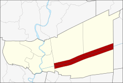 Amphoe location in Pathum Thani Province | |
| Coordinates: 14°1′16″N 100°44′4″E / 14.02111°N 100.73444°ECoordinates: 14°1′16″N 100°44′4″E / 14.02111°N 100.73444°E | |
| Country |
|
| Province | Pathum Thani |
| Seat | Rangsit |
| Area | |
| • Total | 112.124 km2 (43.291 sq mi) |
| Population (2009) | |
| • Total | 184,597 |
| • Density | 1,447/km2 (3,750/sq mi) |
| Time zone | THA (UTC+7) |
| Postal code | 12110 |
| Geocode | 1303 |
Thanyaburi (Thai: ธัญบุรี; IPA: [tʰanjábùriː]) is a district (Amphoe) in Pathum Thani Province. also locate of Bangkok Glass F.C.
History
Mueang Thanyaburi was built by order of King Rama V in 1901. The city name translates to Rice City. At the same time, King Rama V ordered Minburi (มีนบุรี, Fish City) to be built as its twin city. The province was abolished and incorporated into Pathum Thani in 1932.[1]
The district was renamed from Mueang to Rangsit in 1917.[2] In 1938 it was renamed to Thanyaburi.[3]
Geography
Mueang Thanyaburi is located in the eastern part of the Chao Phraya valley that is called Thung Luang. It is easily accessible from Bangkok via the Eastern Outer Ring Road (9) or from Rangsit centre on Highway 305 (Rangsit-Nakhon Nayok)
The main water resource of Thanyaburi is Khlong Rangsit. It was the first canal (Khlong) for irrigation purposes of Siam.
Neighboring districts are (from the north clockwise) Khlong Luang and Nong Suea of Pathum Thani, Ongkharak of Nakhon Nayok Province, Lam Luk Ka and Mueang Pathum Thani of Pathum Thani province.
Administration
The district is subdivided into 6 subdistricts (tambon), which are further subdivided into 12 villages (muban). There are 1 city (thesaban nakhon), 2 town (thesaban mueang), and 1 subdistrict municipality (thesaban tambon) within the district. Rangsit city covers the complete tambon Prachathipat. Sanan Rak town covers tambon Bueng Sanan and Bueng Nam Rak and the town Bueng Yitho cover the complete tambon Bueng Yitho. The subdistrict municipality Thanyaburi covers the tambon Rangsit and Lam Phak Kut.
| No. | Name | Thai | Villages | Inh.[4] |
|---|---|---|---|---|
| 1. | Prachathipat | ประชาธิปัตย์ | - | 77,204 |
| 2. | Bueng Yitho | บึงยี่โถ | 4 | 28,912 |
| 3. | Rangsit | รังสิต | 4 | 21,924 |
| 4. | Lam Phak Kut | ลำผักกูด | 4 | 33,201 |
| 5. | Bueng Sanan | บึงสนั่น | - | 6,986 |
| 6. | Bueng Nam Rak | บึงน้ำรักษ์ | - | 16,370 |
References
- ↑ พระบรมราชโองการ ประกาศ ยุบรวมท้องที่บางมณฑลและบางจังหวัด. Royal Gazette (in Thai) 48 (0 ก): 576–578. 1932-02-21.
- ↑ ประกาศกระทรวงมหาดไทย เรื่อง เปลี่ยนชื่ออำเภอ. Royal Gazette (in Thai) 34 (0 ก): 40–68. 1917-04-29.
- ↑ พระราชกฤษฎีกาเปลี่ยนนามจังหวัด และอำเภอบางแห่ง พุทธศักราช ๒๔๘๑. Royal Gazette (in Thai) 55 (0 ก): 658–666. 1938-11-14.
- ↑ "Population statistics 2009". Department of Provincial Administration.
External links
- amphoe.com (Thai)
| ||||||||