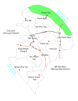
Thanh Tân, Bến Tre
| Thanh Tân Xã Thanh Tân | |
|---|---|
| Commune and Village | |
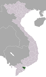
 Location in Mỏ Cày Bắc District | |
 Thanh Tân Location in Mỏ Cày Bắc District | |
| Coordinates: 10°13′51″N 106°19′31″E / 10.23083°N 106.32528°E | |
| Country |
|
| Region | Mekong Delta |
| Province | Bến Tre |
| District | Mỏ Cày Bắc |
| Area | |
| • Total | 7.81 sq mi (20.24 km2) |
| Population (1999) | |
| • Total | 11,051 |
| • Density | 1,410/sq mi (546/km2) |
| Time zone | Indochina Time (UTC+07:00) |
| Postal code | 28906 |
Thanh Tân is a rural commune of Mỏ Cày Bắc District, Bến Tre Province, Vietnam. The commune covers 20.24 km². In 1999 it had a population of 11,051 and a population density of 546 inhabitants/km².[1]
References
- ↑ "List of populated places in Vietnam". Ministry of Information and Communications of Vietnam. Retrieved 2012-08-30.
| |||||||||||||||||||||||||||||||||||||||||||||