Texas State Highway 33
| ||||
|---|---|---|---|---|
 | ||||
| Route information | ||||
| Maintained by TxDOT | ||||
| Length: | 22.7 mi[1] (36.5 km) | |||
| Existed: | 1955 – present | |||
| Major junctions | ||||
| West end: |
| |||
| East end: |
| |||
| Highway system | ||||
| ||||

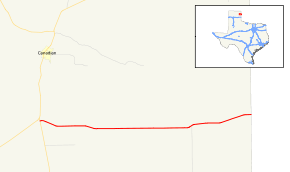
State Highway 33 is a route that runs from U.S. Highways 60 and 83 south of Canadian and travels east to the Oklahoma border, where it becomes State Highway 33. The route was originally SH 170, but was renumbered in 1955.
Previous routes

SH 33 was originally proposed as one of the original 26 state highways in 1917 as SH 13. It was to follow a route from Amarillo northeast through Panhandle then east through Wheeler and into Oklahoma. By 1919, it had been renumbered SH 33 when SH 13 was rerouted. By 1926, SH 33 was rerouted over SH 33A, which was cosigned with U.S. Highway 60. By 1933, it was still under construction. By 1938, SH 33 had been cancelled.

SH 33A was originally a spur route of SH 33, splitting off in Pampa, and travelling northeast next to the a rail route. By 1926, it had been renumbered as the main route and had been moved to a new route between Pampa and Wheeler. By 1933, it was renumbered as SH 152.

SH 33B was a proposed route from Clarendon north through Pampa, and continuing north into Oklahoma. By 1926, portions between Clarendon and Pampa, as well as north of Spearman, were just being built. By that time the route had been renumbered as SH 88 (now SH 70).