Texas State Highway 31
"TX 31" redirects here. TX 31 may also refer to Texas's 31st congressional district.
| ||||
|---|---|---|---|---|
 | ||||
| Route information | ||||
| Maintained by TxDOT | ||||
| Length: | 143.3 mi[1] (230.6 km) | |||
| Existed: | before 1939 – present | |||
| Major junctions | ||||
| West end: |
| |||
|
| ||||
| East end: |
| |||
| Location | ||||
| Counties: | McLennan, Hill, Navarro, Henderson, Smith, Gregg | |||
| Highway system | ||||
| ||||
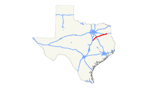
State Highway 31, or SH 31, runs from U.S. Highway 84 northeast of Waco via Corsicana, Athens, Tyler, Kilgore to U.S. Highway 80 in Longview.
History
SH 31 was a route proposed by 1919 to run from Waco northeast via Corsicana and Athens to Tyler, which remains the western portion of its current route to this day. By 1926, the route had been extended northeast to Gladewater. In 1939, this extension was reassigned to U.S. Highway 271, with SH 31 now being extended east to Kilgore over former SH 176. When U.S. Highway 259 was rerouted in 1985, SH 31 was extended northeast into Longview.
Counties and junctions
| County | Location | mi | km | Destinations | Notes |
|---|---|---|---|---|---|
| McLennan | |||||
| Hill | Mount Calm | West end of FM 339 overlap | |||
| East end of FM 339 overlap | |||||
| Hubbard | |||||
| Navarro | |||||
| Dawson | West end of FM 709 overlap | ||||
| East end of FM 709 overlap | |||||
| West end of FM 55 overlap | |||||
| East end of FM 55 overlap | |||||
| Corsicana | |||||
| Interchange | |||||
| Interchange | |||||
| Powell | |||||
| Kerens | |||||
| Henderson | Trinidad | ||||
| Malakoff | |||||
| Athens | Interchange, west end of SL 7 overlap | ||||
| Interchange, west end of US 175 overlap | |||||
| Interchange, west end of SH 19 overlap | |||||
| Interchange, east end of SL 7, US 175, and SH 19 overlaps | |||||
| Murchison | |||||
| West end of FM 1803 overlap | |||||
| East end of FM 1803 overlap | |||||
| Brownsboro | |||||
| Former routing of TX 31 | |||||
| Chandler | |||||
| Smith | |||||
| Tyler | |||||
| Saunders Ave | Interchange | ||||
| Fleishel Ave | Interchange | ||||
| West end of FM 850 overlap | |||||
| East end of FM 850 overlap | |||||
| Gregg | |||||
| Kilgore | Interchange | ||||
| West end of US 259 Bus. overlap | |||||
| Interchange, east end of US 259 Bus. overlap, west end of US 259 overlap | |||||
| Interchange, east end of US 259 overlap | |||||
| Interchange | |||||
| Longview | |||||
| 1.000 mi = 1.609 km; 1.000 km = 0.621 mi | |||||
References
- ↑ Transportation Planning and Programming Division. "State Highway No. 31". Highway Designation Files. Texas Department of Transportation. Retrieved 2010-10-30.
