Texas Natural Resources Information System
 | |
| State Government | |
| Industry | Geographic Information Systems (GIS) |
| Founded | Austin, Texas (1968) |
| Headquarters | Austin, Texas, USA |
Key people | Richard Wade, Director |
| Products |
Historical and Current Aerial Photography Current and Historical USGS Printed Maps GIS Education Public Domain Data Warehouse |
Number of employees | 14 |
| Website | tnris.org |
The Texas Natural Resources Information System (TNRIS) is the principal state archive in Texas for natural resources data. TNRIS provides a central access point for Texas Natural Resources data, census data, digital and paper maps, and information about datasets collected by state agencies and other organizations. TNRIS is a division of the Texas Water Development Board (TWDB).
About TNRIS
TNRIS was established by the Legislature in 1968 as the Texas Water-Oriented Data Bank. In 1972, after four years of growth and diversification, it was renamed the Texas Natural Resources Information System. The mission of TNRIS is to provide a "centralized information system incorporating all Texas natural resource data, socioeconomic data related to natural resources, and indexes related to that data that are collected by state agencies or other entities." (Texas Water Code, 16.021).
The staff includes individuals trained in the natural, computer and library sciences. TNRIS supplies data to government, academia, private sector, and to the public.
The TNRIS Data Catalog - By the Numbers
Over 1,000,000 frames of Aerial Photography
Over 50 unique datasets exceeding 20 TB
Monthly average data downloads exceeding 1 TB
Texas Water Development Board
TNRIS is a part of the Texas Water Development Board (TWDB) under the Operations and Administration division.
Texas Geographic Names Committee
The Director of TNRIS acts as the coordinator of the Texas Geographic Names Committee, the body charged with standardizing geographic names for the state of Texas.
The TNRIS offices are located in the Stephen F. Austin Building, 1700 North Congress Avenue, in Austin, Texas.
Organizational structure
Research and distribution
The Research and Distribution Center (RDC) provides research materials and assistance in locating maps, reports, and information. The Research Center collection includes aerial photographs, USGS topographic maps, wetlands maps, Census maps and reports, and water resources records.
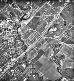
Aerial Photographs TNRIS has a large collection of remotely sensed imagery from various sources that is available to researchers and to the public. Holdings include photographs from the Texas Department of Transportation, the USDA-SCS, the USGS, NASA and private aerial survey companies. These aerial photos span several decades and can be used for historical change analysis. The collection (over 600,000 photos) contains predominantly black-and-white prints. The photography archive is open to the public, but materials must be used and copied in-house. RDC staff are scanning this valuable aerial photo collection and will make it available on CD-ROM and on the Internet.
Maps TNRIS holdings include many types of federal, state, and specialized maps. TNRIS serves as a repository and distribution center for USGS topographic maps, National Wetlands Inventory (NWI) maps, current FEMA flood hazard maps, river basin and aquifer maps, well driller’s maps, and historic topographic maps. The current series of USGS topographic maps for Texas can be purchased from TNRIS. Historic topographic maps, FEMA maps, land use maps, and wetland maps can be used for research in-house or sent out to be copied. River basin, aquifer, and well driller’s maps are produced on demand. TNRIS’ collection of historic aerial photos are being scanned and made available in digital format. RDC staff assists customers with research projects, fills map orders, and arranges photocopying and reproduction services.
StratMap
Unlike the archival and clearinghouse activities of other TNRIS branches, the main function of The Texas Strategic Mapping Program (StratMap) is to create data for public distribution. StratMap manages the production and maintenance of seven high-resolution digital data layers for each of the 4376 7.5-minute quadrangles covering Texas. The statewide datasets include 1:12,000 scale color infrared orthoimagery, 1:24,000 scale digital elevation models and 1:24,000 scale digitized hypsography (elevation contours and spot elevations), hydrography (flowing water, water bodies and marshlands), soils (NRCS Soil Survey Geographic Data Base coverages), transportation (streets, roads, railroads and pipelines) and boundaries (counties, city limits, federal lands, state parks). Through StratMap, Texans receive the most comprehensive and highest quality statewide base mapping data layers available in the USA. With the completion of phase 1 data layers, the second phase of StratMap continues to locate, acquire, and produce geospatial data layers in support of spatial analyses and mapping efforts in the State of Texas.
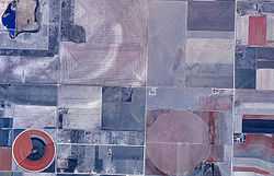
Currently, Stratmap has engaged in a collaborative partnership among state agencies and several technical contributing partners with interest in creating a new statewide aerial map for Texas. The project is based on a partnership with the U.S. Department of Agriculture Farm Services Agency and Texas. The images are acquired by airborne digital cameras and controlled by global positioning systems. Specialized processing removes optical distortions and assembles all of the images into a unified mapping coordinate system. This production process creates an image which has all of the utility of a map. The processed images are referenced to a USGS coordinate grid system and made available as individual image map files. All of these images are in the public domain and available from TNRIS and the Farm Services Agency. The project is also breaking new ground in producing imagery that will have one-half meter resolution which is twice as much detail as previously acquired for the state.
StratMap Data Layers
Transportation
The StratMap statewide transportation dataset is a publicly available digital data layer which serves as a cartographic product for seamless basemap production.
Political Boundaries
The StratMap political boundary dataset contains: Political jurisdictions, City boundaries, County boundaries, State boundaries and federal parks, Landmark boundaries (airports, universities,
Hydrography - NHD
The 1:24,000 National Hydrography Dataset (NHD), jointly developed by the US Geological Survey (USGS) and the Environmental Protection Agency (EPA), is a hydrologic data network designed to show all surface water features including rivers and streams, ponds and lakes, springs, canals, wetlands, and shorelines.
Elevation (Hypsography/Digital Elevation Models/LiDAR)
The elevation data consists of vector contours and other raster based elevation dataset, e.g. DEMs, NED, and LiDAR
Elevation
Soil Survey Geographic Dataset (SSURGO)
The SSURGO dataset was developed in partnership with the Natural Resources Conservation Service (NRCS) and is an updated digital version of the county soil surveys.
National Agriculture Imagery Program (NAIP) and DOQQ Imagery
A Digital Orthophoto Quadrangle (DOQ) is a digital mapping product that combines the geometric qualities of a map with the detail of an aerial photograph. DOQs are digitally derived aerial photos that have been corrected so image distortion caused by perspective, camera tilt, and terrain relief are removed. Distances, bearings, and area calculations can all be measured on DOQs.
Borderlands Information Center
The Texas/Mexico Borderlands Information Center (BIC) is a central repository, dissemination, and referral center for natural resource and census data covering both sides of the Texas/Mexico border region. It also promotes closer ties, communication, and data sharing among agencies involved in border issues to reduce redundant data collection and project activities. The BIC is supported by the EPA, which provides funding for a full-time staff member, data purchases, and other expenditures needed to operate the Center and establish contacts in Mexico. The aim of the BIC is to be thoroughly binational in scope and to encourage a free interchange of data and information among institutions on both sides of the border.
The BIC provides a catalog of data and information, several Internet websites, listings of data available through the center, and a newsletter to promote data sharing and discuss border-related issues. BIC staff conduct an ongoing inventory of borderlands geospatial data and information about environmental projects. An outreach function of BIC is sponsorship of border meetings and symposia, as well as workshops and presentations on border environmental issues. The geographic area covered is approximately 100 kilometers either side of the Rio Grande in Texas and Mexico. Data include water quality, level and streamflow, meteorological reports, paper and digital maps, aerial photos and satellite imagery, and census publications.
High Priority Imagery and Data Sets (HPIDS)
The Council on Competitive Government, has established a new procurement process designed to strengthen Texas' capabilities to create and maintain digital maps for government entities and the public. This new process was established through the use of a state master contract referred to as High Priority Imagery and Data Sets (HPIDS). High priority data sets are digital map layers used for emergency management, economic development and as a resource in making informed policy decisions.
New data acquisition projects are determined by identifying type of data required, location, specification, budget and timeline for delivery. Data acquisition, production and independent quality assurance and quality control (QA/QC) responsibilities are awarded to private geospatial contractors through the Council on Competitive Government (CCG) High Priority Imagery and Data Sets Contract. After the final deliverables are accepted, the data are placed in the public domain.
Benefits
Strategic Collaboration and Integration
- Combined professional expertise to enhance project specifications resulting in better data products. Working together generates new ideas for creating smarter geospatial data that can be used by many organizations. If desired, we will help you select the company that will best suit your needs.
Taxpayer Value
- By combining our geospatial projects, we can acquire a larger area at a discounted unit price and reduce duplication.
Efficient Purchasing Process
- Since the contract with the vendors is already in place, a contract between you and the vendor not required. A statement of work and a purchase order will suffice.
Project Assistance and Coordination
- There are several options ranging from self service to full service. We can help you seek additional project partners to expand the area of interest or to share the project cost.
Continuous Improvement
- Each project performed under the HPIDS Contract takes away valuable experiences that help improve data standards and overall project management.
Increased Opportunity for Cost Sharing
- By notifying us about a potential project, you may be alerted to another entity interested in purchasing a similar product or area of interest.
Pre-screened Companies with Geospatial experience
- Each of the selected companies were carefully evaluated for project experience and success. Qualifications include large scale project experience, technology innovation, professional staff, and available resources.
External links
- tnris.org Official Agency Site
- Texas Water Development Board Parent Agency