Terešov
| Terešov | |
|---|---|
| Municipality | |
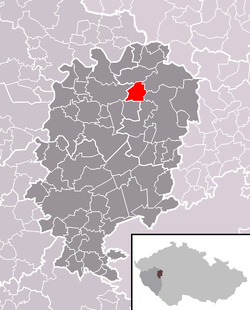 Location in Rokycany District | |
 Terešov Location in the Czech Republic | |
| Coordinates: 49°54′10″N 13°41′49″E / 49.90278°N 13.69694°ECoordinates: 49°54′10″N 13°41′49″E / 49.90278°N 13.69694°E | |
| Country |
|
| Region | Plzeň |
| District | Rokycany |
| Area | |
| • Total | 6.7 km2 (2.6 sq mi) |
| Elevation | 408 m (1,339 ft) |
| Population (2006) | |
| • Total | 152 |
| • Density | 23/km2 (59/sq mi) |
| Postal code | 338 08 |
| Website | http://www.sweb.cz/teresov/ |
Terešov is a village and municipality (obec) in Rokycany District in the Plzeň Region of the Czech Republic.
The municipality covers an area of 6.7 square kilometres (2.6 sq mi), and has a population of 152 (as at 28 August 2006).
Terešov lies approximately 19 kilometres (12 mi) north-east of Rokycany, 29 km (18 mi) north-east of Plzeň, and 56 km (35 mi) west of Prague.
References
| Wikimedia Commons has media related to Terešov. |