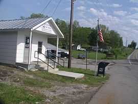
Tennessee State Route 266
| ||||
|---|---|---|---|---|
| Route information | ||||
| Maintained by TDOT | ||||
| Length: | 39.81 mi[1] (64.07 km) | |||
| Major junctions | ||||
| South end: |
| |||
|
| ||||
| North end: |
| |||
| Location | ||||
| Counties: | Rutherford, Wilson | |||
| Highway system | ||||
| ||||
Tennessee State Route 266 is a state highway that exists within Rutherford County, Tennessee, USA. The western terminus is in a currently undeveloped section of Smyrna, Tennessee west of an interchange with Interstate 24. The eastern terminus is at Lebanon.
Route description

For most of its length through Smyrna, Route 266 is a four-lane highway called Sam Ridley Parkway, named for the mayor of the city from 1947 to 1987. (Sam Ridley was forced to resign in 1987 due to a conflict-of-interest suit; as a testament to his popularity, his identical twin brother Knox was promptly instated as mayor.)[2] Once an undeveloped highway forming part of a beltway around Smyrna and serving the Smyrna Airport, Sam Ridley Parkway now features numerous strip malls, apartments, a high school, and a hospital. Sam Ridley Parkway officially has a terminus at an intersection with Jefferson Pike, where the road becomes Nissan Drive/Tennessee State Route 102. State Route 266 continues eastward along Jefferson Pike.
Jefferson Pike is almost entirely undeveloped and rural, passing by a large Allied Waste landfill near Walterhill. It has an interchange with Tennessee State Route 840. The highway passes through Lascassas, an unincorporated community northeast of Murfreesboro, Tennessee and the geographical center of Tennessee.
See also
- List of Tennessee state highways
The highway had severe roadworks in 2009 lasting for 8 months
