Ten Mile River (Seekonk River)
.jpg)
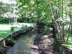
The Ten Mile River is a river within the U.S. states of Massachusetts and Rhode Island. It flows approximately 22 miles (35 km) and drains a watershed of 54 square miles (140 km2).[1]
The North Attleborough National Fish Hatchery is located in its upper reaches, and the river offers stocked trout fishing in the spring.
The Ten Mile River was badly polluted in the mid 1900s but has subsequently been remediated. Although there are still issues with metals and sediments in the water, the river and nearly all its tributaries are now designated as Class B waters (fishable, swimmable).
Course
The river begins at Savage Pond, near the corner of High and Chestnut Streets, in Plainville, Massachusetts. From there, it flows generally south through North Attleborough, Attleboro and Seekonk before entering Rhode Island and flowing through Pawtucket and East Providence where it flows over the Omega Dam into the Seekonk River.
Crossings
Below is a list of all crossings over the Ten Mile River. The list starts at the headwaters and goes downstream.
- Plainville
- High Street
- Fuller Street
- West Bacon Street
- Cooney Avenue
- North Attleborough
- Broad Street
- North Washington Street
- Fisher Street
- East Washington Street (U.S. 1) (Twice)
- Chestnut Street
- East Washington Street (U.S. 1)
- Mount Hope Street
- Towne Street
- Freeman Street
- Cedar Road
- Attleboro
- Interstate 295
- Interstate 95
- West Street
- Water Street
- Mechanic Street
- Hodges Street
- County Street (MA 123)
- Wall Street
- Olive Street
- Lamb Street
- Thacher Street
- Tiffany Street
- Bridge Street
- Seekonk
- Pond Street
- Pawtucket
- Central Avenue
- Armistice Boulevard (RI 15)
- East Providence
- Newman Avenue (RI 152)
- Pleasant Street
- Pawtucket Avenue (U.S. 1A/RI 114)
- North Broadway
- Roger Williams Avenue
Tributaries
In addition to many unnamed tributaries, the following brooks and rivers feed the Ten Mile:
- Scotts Brook
- Beaver Brook
- Bungay River
- Thacher Brook
- North Brook
- South Brook
- Sevenmile River
- Hidden Hollow Brook
- Blageddy Stream
- Wilde River (actual Wilde Brook)
- Coles Brook (not to be confused with Cole River)
Grassroots organizations
See also
- Boston and Providence Railroad Bridge
- List of rivers in Massachusetts
- List of rivers in Rhode Island
- Seekonk River
- Blackstone River
References
External links
- Maps from the United States Geological Survey
- Ten Mile River Watershed Council
Coordinates: 41°50′07″N 71°21′44″W / 41.8354°N 71.3622°W