Tekirdağ Çorlu Airport
| Tekirdağ Çorlu Airport DHMİ Tekirdağ Çorlu Havalimanı | |||||||||||
|---|---|---|---|---|---|---|---|---|---|---|---|
|
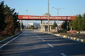
Entrance to Tekirdağ Çorlu Airport. | |||||||||||
 TEQ | |||||||||||
| Summary | |||||||||||
| Airport type | Public/Civil, Military | ||||||||||
| Operator | General Directorate of State Airports Authority[1] | ||||||||||
| Location | Çorlu | ||||||||||
| Elevation AMSL | 574 ft / 175 m | ||||||||||
| Coordinates | 41°8′18″N 27°55′9″E / 41.13833°N 27.91917°E | ||||||||||
| Website | http://corlu.dhmi.gov.tr/ | ||||||||||
| Runways | |||||||||||
| |||||||||||

Terminal building of Tekirdağ Çorlu Airport.
Tekirdağ Çorlu Airport (IATA: TEQ, ICAO: LTBU) (Turkish: Tekirdağ Çorlu Havalimanı) is a military and public airport in Çorlu, a town in Tekirdağ Province, Turkey. Opened to public/civil air traffic in 1998,[2] the airport is 10.5 km (6.5 mi) east of Çorlu.[3]
Airlines and destinations
| Airlines | Destinations |
|---|---|
| Borajet | Ankara |
| Turkish Airlines operated by AnadoluJet | Ankara |
References
External links
| Wikimedia Commons has media related to Tekirdağ Çorlu Airport. |
| ||||||||||||||||||||||